3D Mapping Of Reinforcement For Construction Projects
Published: 6 March 2023
Last Modified: 16 January 2024
There is a growing trend in the construction industry for using machine learning and 3D mapping to help streamline the construction process. An example of this can be seen in the use of Ground-Penetrating-Radar (“GPR”) to generate augmented reality images that can be used to provide structural engineers with valuable information without the need for expensive time-consuming drilling and other methods of obtaining information. In addition, 3D modelling ensures that the engineer or builder does not need to acquaint themselves with the complex task of interpreting 2-dimensional GPR data. Instead, a collection of 2D data sets is joined together to provide the client with a comprehensive 3D data set that they can then use to make informed decisions about coring, drilling, and any other structural work that needs to be carried out. Furthermore, 3D mapping and modelling can also be used to identify material property information on-site as well as to create an enhanced knowledge base of the site to be able to inform future decisions and prevent costly rework in the future.
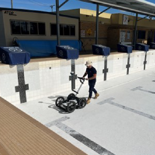
A case study can be seen in the following images, where our Sunshine Coast Managing Director, Aidan, attended a building site in Caloundra to provide an overview of a roof slab used to support a telecommunications antenna as well as a storage structure on top of a residential apartment block. The structural engineers in charge of the redevelopment required this information to make informed decisions about the design and how best to safely undertake structural upgrades. Using 3D laser scans conducted using an IDS Georadar C-Thrue GPR scanner and grid, the images were generated at a fraction of the cost and time required for traditional mapping methods. Using this information, the engineers were able to assess the overall strength of the slab and whether any additional structural reinforcement was required. This information was then passed on to the project manager who could then use it to advise clients of the level of risk associated with the design and allow them to make the best-informed decision for the overall cost-effectiveness of the design.
3D mapping is an exciting new feature of GPR, enabling non-experts to see things that they may not have been able to see before through the limitations of traditional 2D mapping methods. It enables operators to map the complex geometries of structural features quickly and accurately on the ground floor with minimal risk of missed targets, as well as locate utilities and buried assets with precision.
South-East Scanning can provide clients with detailed 3D models of both static and dynamic structures using 3D laser scanning to capture the shape of the structure in three dimensions. Our reporting provides our clients with the highest quality data that they need to make informed decisions about the structural design of their projects.
Roof slab was 200mm thick with regular 150-200mm reinforcement bar spacings appearing to be rectangular N16 bars.
Note the angle of the reinforcement bar relative to the structure. The slab in front of shed structure was 200mm thick with regular 150-200mm reinforcement bar spacings appearing to be rectangular N16 bars. With some variation as can be seen by the double reinforcement bar layer.