What Is GPR?
Ground Penetrating Radar (“GPR”) is a geophysical locating technique that uses radio waves to take images below the ground’s surface in a minimally invasive manner. GPR has the advantage that crews can pinpoint underground utilities without having to disturb the ground or core into an existing structure to determine the nature of the services that may be running through it.
GPR uses energy waves within the microwave band. These frequencies range from 1 to 1000MHz. GPR uses two pieces of equipment: a transmitter and an antenna. The transmitter transmits electromagnetic energy to soil and other materials. Ground Penetrating Radar works in two ways. It emits a pulse into ground and records the echoes from subsurface objects. GPR imaging devices can also detect variations in ground material composition.
The object’s density reflects, scatters and refracts electromagnetic impulses when they hit it. The receiver records the variations in the signals. The GPR system uses software to translate these signals into images of objects in the subsurface. This is how it can be used to map utilities and structures buried in ground or man-made structures.
What does GPR tell us?
GPR signals are useful in finding a variety of items. This subsurface tool works best when there is a significant difference in the electromagnetic properties of the target and the surrounding material. GPR is used often to map items made from the following materials.
- Metal,
- Plastic,
- PVC,
- Concrete,
- Natural materials
There are many possible uses. It is often used to detect:
- Underground utilities lines and pipes
- Ground strata changes
- Geological features and rock obstacles
- Air pockets and voids
- Excavated and back-filled regions
- Groundwater tables
- Bedrock
UTILITY MAPPING APPLICATIONS
GPR technology is used to improve the accuracy of subsurface utility mapping when combined with traditional methods of locating. GPR can be used to locate unmarked utilities and structures. It also assists with excavation projects.
These types of applications offer significant advantages.

GROUND PENETRATING RADAR: WHAT ARE THE ADVANTAGES?
GPR is a cost-effective, non-invasive method of surveying. It is invaluable before workers excavate a site, or drill / core into an existing concrete structure.
- GPR can be used in public areas and on a variety of projects.
- It can detect metal and non-metal objects as well as voids, underground irregularities and other anomalies.
- The data is quickly available and covers a large area.
- You can regulate frequency to achieve a range resolution and penetration depths.
- The data collected during the survey can either be viewed immediately or used in future projects.
- It is not necessary to dig, excavate, or disturb the ground or structure.
- It is a highly cost-effective option, and one that can serve to minimise the risk of damage to either public or private assets.
WHERE CAN GPR TECHNOLOGY BE USED?
GPR, like all other types of radar imaging, can deliver varying degrees of accuracy depending upon the conditions.
SOIL PROPERTIES AND GROUND MATERIAL
GPR works by sending tiny pulses of energy into the ground and then recording the strength and time taken for them to return to the receiver. A scan is a sequence of pulses that are applied to a single area. Some of the GPR energy pulses reflect to the receiving antenna. However, some energy continues to travel through a material until it dissipates or ends the scanning session. The properties of the materials can affect the rate at which signal dissipation occurs.
GPR can be applied to many ground materials, such as:
- Soil,
- Rock,
- Ice,
- Water,
- Pavement,
- Concrete structures.
Reflection occurs when the energy pulse passes through a material that has different electrical conductivity or dielectric permittivity. The contrast between the conductivities and dielectric constants between the materials determines the strength or amplitude of the signal. For example, a pulse moving from wet to dry sand will produce strong reflections, compared to the weak reflections produced when moving from dry to limestone.
DEPTH
The maximum penetration depth for concrete usually is about 600mm GPR signals depth in moist clays or other high conductivity materials is much shallower and can reach approximately 1 meter.
WATER CONTENT
The substrate’s dielectric permittivity is also an important factor. The ease at which materials can become polarised is called dielectric permittivity. Dielectric permittivity is greatly affected by the amount of water in the material. Some materials can become polarised when there is an electric field.
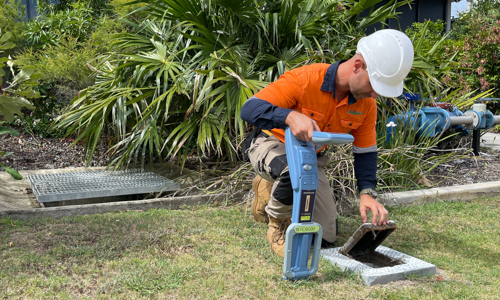
OUR SCANNING TEAM
The team at South-East Scanning use a Proceq GS8000 scanner as well as an IDS Georadar C-Thrue concrete scanner. Our team are fully trained and certified to use GPR technology for the investigation of concrete structures as well as subsurface utilities. We can rapidly produce insight about reinforcement, post-tension cables and services that may be embedded in a concrete structure and use GPR in tandem with EMF locating equipment to produce the best possible result for your project. We can produce line scans to map reinforcement and services, as well as comprehensive 3D imaging to assist you in making the right decision for your project.
Contact us today to find out how our services can assist you on your project!