Ground Penetrating Radar (GPR) has become a cornerstone technology for modern construction projects. With its ability to safely and non-destructively peer into the earth's subsurface, GPR assists engineers and architects in surveying potential obstacles, soil characteristics, and buried utilities before a project even breaks ground. In this in-depth exploration, we'll walk through the essential steps construction professionals and civil engineers need to master in order to harness the full potential of GPR technology.
Step 1: Planning and Preparation
The journey of a GPR project begins with meticulous planning. This step is essential for ensuring that GPR is used in the most effective and efficient way possible.
Assessing Project Requirements
Understanding the scope of the project is about more than just reading blueprints—it’s about visualising the entire process and pinpointing where GPR can provide the most value. Is the construction site in an urban or rural area? Will the project involve extensive digging or large-scale building? The answers to these questions will guide the use of GPR technology effectively.
Identifying Areas for GPR Scanning
Knowing where to look is as important as knowing how to look. By collaborating with surveyors and geologists, construction professionals can identify key target areas that require GPR assessment. This might involve marking out zones where utilities run, locating potential sinkhole areas, or defining regions where soil composition is critical.
Obtaining Necessary Permits and Permissions
GPR scanning may require access to private properties or rights of way. It’s imperative to secure all the required permits and permissions in advance. Government regulations and utility authorities can have strict guidelines, and navigating these ahead of time will prevent costly delays during the scanning process.
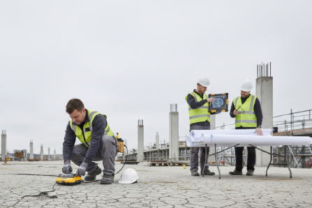
Step 2: Equipment Setup
Selecting and preparing the right equipment for a GPR survey can make or break the accuracy and success of the project.
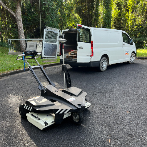
Choosing the Right GPR System
Not all GPR systems are created equal. The choice between different frequencies, antennas types, and integrated software will depend on the project’s unique demands. More complex projects, such as those in congested urban areas, may benefit from a more compact but sophisticated unit, whereas larger, more straightforward projects might utilise systems with broader scanning capabilities.
Calibrating and Configuring the Equipment
Once the GPR system is selected, it must be calibrated to ensure the accurate generation of subsurface data. Fine-tuning the equipment’s settings is vital, and this process should be conducted onsite to account for environmental factors that could impact the readings.
Ensuring Proper Safety Measures
Any construction site is a domain where safety must be paramount. GPR emits radiation, although at low levels, and following all safety regulations is crucial. This step includes training the team in proper usage and setting up protective barriers for those who are not directly involved in the GPR scanning process.
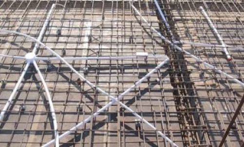
Step 3: Data Collection
The heart of a GPR survey lies in its data collection, where professionals weave together a detailed profile of underground conditions.
Conducting GPR Scans
With the equipment ready, it’s time to begin scanning. This may involve moving equipment over the surface in a systematic pattern, or it might require fixed-point analysis for more precise areas.
Interpreting and Analysing Data
The data collected may be in the form of electromagnetic waves reflected from subsurface anomalies. Advanced processing can unfold these reflections into meaningful information about utility depths, soil types, or even buried structures. Software skills become invaluable here, as does experience in interpreting GPR data effectively.
Documenting Findings
Accurate data is nothing without proper documentation. Each finding must be recorded in a detailed and organised manner, often using GPS coordinates to create spatially accurate representations. This documentation serves as the cornerstone for the remainder of the project, influencing all subsequent planning and decision making.
Step 4: Data Processing and Analysis
Once the raw data is collected, it must be transformed into actionable insights through processing and analysis.
Cleaning and Filtering Raw Data
Raw data can be noisy and filled with extraneous information. Signal processing techniques are used to clean the dataset, removing unwanted signals and preparing it for the next step of analysis.
Creating Subsurface Maps and Images
The processed data is then utilised to map out the subsurface or even create 3D visualisations of the underground environment. This step requires a delicate balance of scientific acumen and software proficiency to present a clear picture of the subsurface situations.
Identifying Potential Anomalies or Hazards
The final analysis must be able to flag potential hazards or unexpected findings. This might include the discovery of a previously unknown underground water flow, a utility that was inaccurately mapped, or even subsurface voids that could compromise the structural integrity of future construction projects.
Step 5: Reporting and Communication
The insights gleaned from GPR surveys are only as good as the communication and implementation that follows them.
Summarising the Results
A comprehensive report should detail the entire GPR survey, including methods, results, and significant findings. It should be accessible to all stakeholders, not just those with specialized knowledge in GPR.
Presenting Findings to Stakeholders
Transparency is key in any construction project. Findings and reports must be presented to all stakeholders—engineers, architects, contractors, and even insurers or public authorities—allowing them to make informed decisions about the project’s next steps.
Collaborating with Other Professionals
The value of GPR data increases when it is integrated with the knowledge of other professionals in the field. Collaboration is critical, and GPR teams should work closely with specialists in a variety of construction-related disciplines to ensure the smooth functioning of the project.
Conclusion
Ground Penetrating Radar (GPR) has completely transformed the construction industry, empowering professionals to explore the depths beneath the surface with unparalleled precision. By meticulously following the step-by-step instructions provided in this comprehensive guide, construction experts and civil engineers can fully leverage the extraordinary capabilities of GPR technologies. This, in turn, will result in the execution of safer, highly efficient, and ultimately more successful construction projects, elevating the standards of the industry as a whole.