South-East Scanning offers advanced ground-penetrating radar (GPR) data processing services that go far beyond standard utility locating. By combining high-resolution scanning with cutting-edge analysis techniques, we deliver depth slices, 3D subsurface visualisations, and volumetric void assessments to support engineers, councils, archaeologists, and asset managers in making informed, risk-conscious decisions.
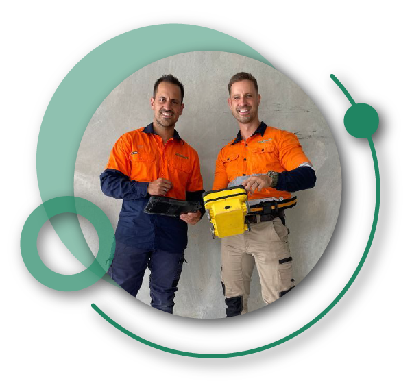
South-East Scanning was founded by Aidan and Dion, two brothers from Melbourne, who brought together their extensive experience in the built environment and professional services sectors.
After relocating to South-East Queensland, they established South-East Scanning to fill a niche in the building and construction industry, specialising in ground-penetrating radar, concrete scanning, non-destructive testing, and utility locating services. Their background provided a strong foundation for the business, allowing them to offer expert insights and innovative solutions to meet the complex needs of their clients in the region.
At South-East Scanning, our mission is to help our clients understand sub-surface structures and mitigate their risk with our expertise in ground penetrating radar and utility detection. We are a family business with unique insights and a commitment to our clients’ success.
We look forward to assisting you. Please call 1300 175 543 or use the form below for a fast response.
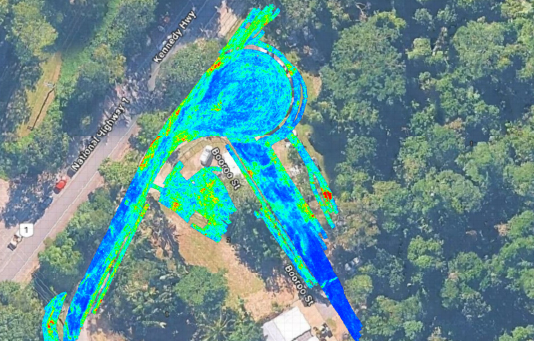
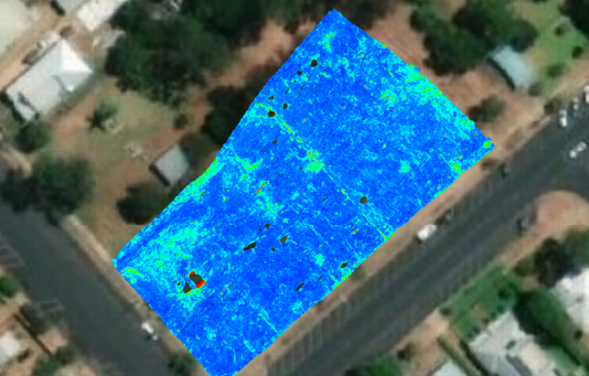
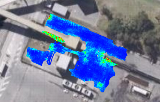
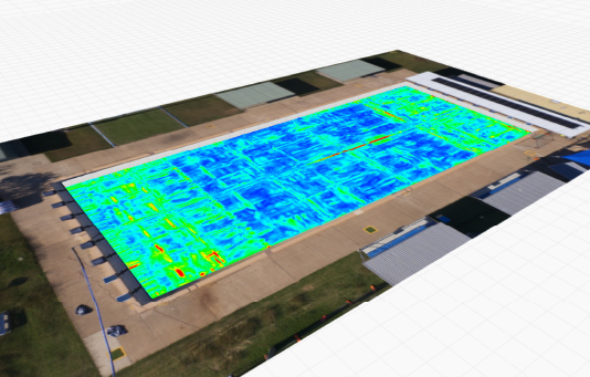
Using detailed grid scans and post-processing algorithms, we generate horizontal depth slices that provide precise, layer-by-layer imaging of the subsurface. This technique enables detection of features that traditional line scans may miss, such as:
Subtle voids and air gaps
Material layering and transitions
Buried objects and structural irregularities
Shifts in compaction or fill consistency
Our processed data delivers precise spatial context for buried features, whether beneath concrete slabs, roadways, or natural terrain.
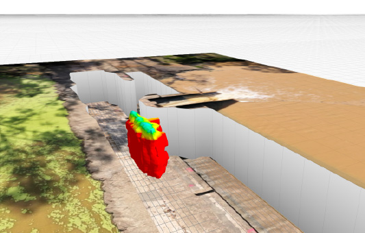
Our volumetric assessment capabilities allow us to identify and estimate the size of voids, cavities, and subsurface anomalies. This is especially valuable when evaluating potential risks to infrastructure, assessing ground stability, or verifying areas for remediation. By measuring subsurface disturbances’ shape, depth, and volume, we help clients address issues before they escalate into costly or hazardous failures.
Structural & Geotechnical Applications
Advanced GPR processing is ideal for: Assessing concrete integrity in slabs, beams, and retaining walls Identifying signs of delamination, erosion, or subsurface washout Investigating ground conditions beneath dams, embankments, and roadways Supporting engineering design and safety assurance through accurate, non-destructive insights These insights are delivered in a professional report format, complete with annotated imagery, interpreted depth models, and expert recommendations.
Archaeology & Cemetery Mapping
Our non-invasive approach is also suited to archaeological surveys, heritage investigations, and cemetery mapping. We provide clear imaging of buried structures, unmarked graves, and cultural features, supporting sensitive site exploration without the need for intrusive excavation.
Why Choose South-East Scanning?
Our advanced GPR processing helps you safely, accurately, and confidently uncover what lies beneath the surface.
Multi-frequency radar for shallow and deep targets
Clean, detailed 3D subsurface maps and depth slices
Accurate volumetric data for voids and buried objects
Trusted by engineers, councils, consultants, and heritage specialists
Reporting tailored to technical and non-technical audiences
Our Simple and Easy 6 Step Process!
1. Online Quote
Complete our online quote form and one of our team members will be in contact shortly.
2. Site Visit
We come on-site and view the job, providing you with an accurate quote.
3. GPR Scan
We complete our GPR Scan of the job, covering all areas required.
4. Instant Engineer's Report
We provide a site summary report, detailing our findings.
5. Option To Cut Or Core
We provide the option to cut or core the area, which is the process of cutting or drilling.
6. Follow Up Advice
We provide follow up advice on what the best course of action is, prevention and potential problems in the future.