Banana Shire Council engaged South- East Scanning to investigate suspected water ingress beneath the Olympic swimming pool at the Biloela Aquatic Centre. With ongoing structural concerns and visible signs of pool floor degradation, the council required accurate, non- destructive testing to assess the condition beneath the tiled slab. Our team was called in to provide actionable, high- resolution data to support informed decision- making regarding maintenance and remediation.
Our Objective: Subsurface Water Ingress Investigation
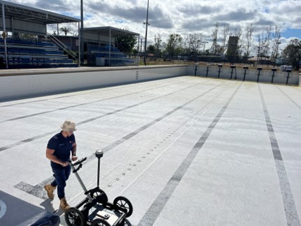
Bioela Olympic Swimming Pool
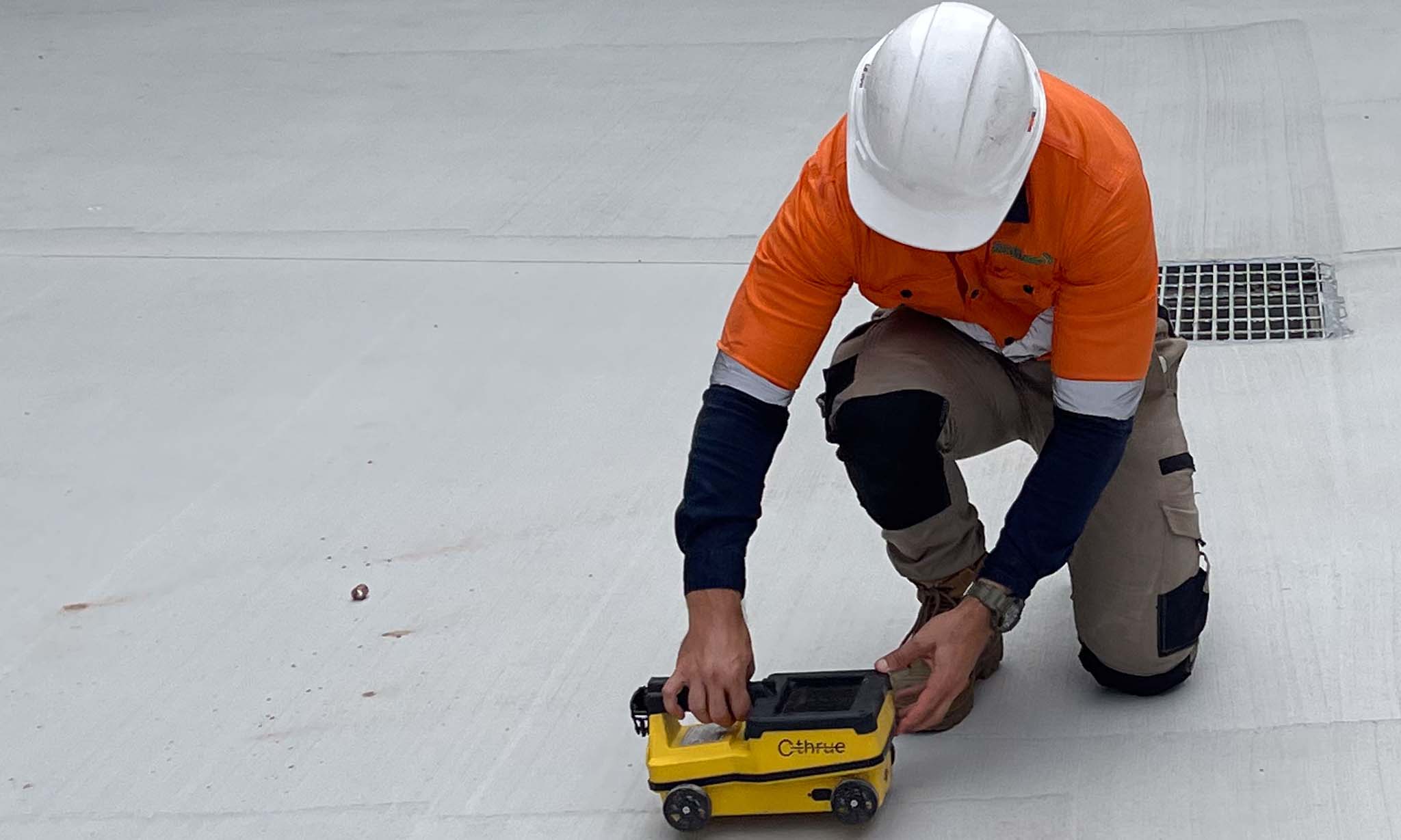
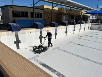
To carry out the survey, South- East Scanning deployed the **Mala GX 160 Mhz ground- penetrating radar system**, mounted on a robust 4- wheel trolley. This antenna was selected for its deep penetration capabilities and its suitability for detecting subsurface anomalies such as voids, differential moisture zones, and changes in material density. GNSS tracking was simultaneously recorded using the **Emlid Reach RS 2 base and rover system**, ensuring the resulting dataset was georeferenced with centimetre- level accuracy.
The survey was conducted across the entire base of the Olympic pool using parallel transects spaced approximately 500 mm apart to ensure comprehensive spatial coverage. Given the tiled nature of the surface and the large scan area, particular care was taken to avoid data dropouts and to maintain consistent speed and antenna contact. All data was recorded using the **Mala HDR Controller** and subsequently processed in **Geolitix**, an advanced GPR interpretation platform that allows for volumetric modelling and layered time- slice visualisation.
How We Helped:
How We Helped:
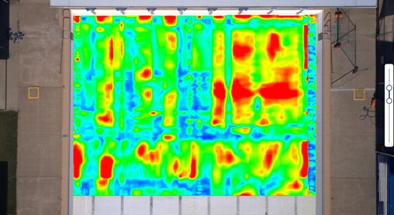
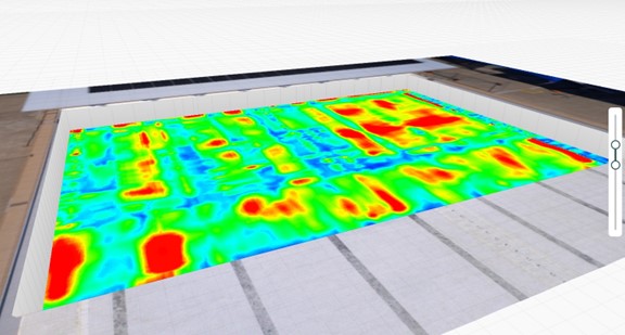
Through depth slicing and amplitude analysis, we were able to identify several subsurface anomalies potentially associated with voiding and moisture ingress, particularly concentrated towards the centre and shallow end of the pool. Areas of high dielectric contrast, visible in both plan and oblique 3 D views, indicated potential paths of water migration and zones of reduced compaction.
Deliverables included
- 3D depth slice models and colour- coded amplitude heatmaps
- Exported orthomosaics overlaid with subsurface data
- A complete technical interpretation with georeferenced anomaly mapping
- Recommendations for further targeted investigation and monitoring
Outcome
The client was provided with a clear understanding of subsurface conditions and could prioritise targeted repairs. Our visual outputs were presented at an engineering review session and commended for their clarity, precision, and practical value in guiding remediation planning. Contact South East Scanning today and lets work together to help you complete your project!


