Until recently, ground-penetrating radar (GPR) was – by definition – a ground-based operation. Whether mounted to a cart or vehicle, scanning required boots on the ground and access to the surface in question. But that’s changing fast.
The rise of drone-mounted GPR (also known as UAV-based GPR) is revolutionising how we conduct subsurface investigations, particularly in remote, rugged, hazardous, or large-scale environments where traditional methods are impractical or inefficient. For industries like mining, environmental remediation, defence, and major infrastructure development, this technology unlocks new capabilities, speeds up operations, and reduces risk.
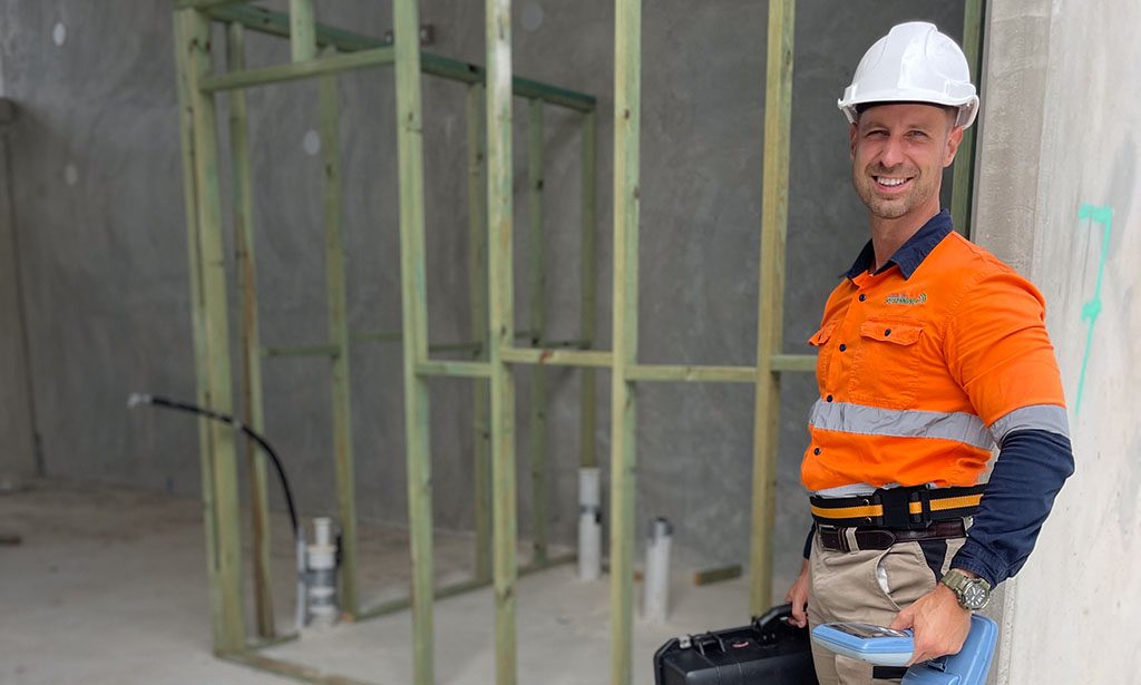
At South East Scanning, we’re watching this space with keen interest. While our work has primarily focused on terrestrial scanning of concrete, utilities, and structural elements, the aerial GPR frontier presents exciting possibilities, especially in the vast, open landscapes of regional Queensland and along Australia’s coastal corridors.
What is Drone-Mounted GPR?
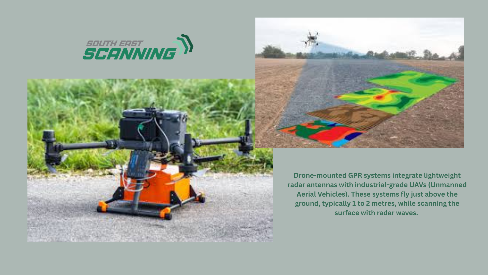
Drone-mounted GPR systems integrate lightweight radar antennas with industrial-grade UAVs (Unmanned Aerial Vehicles). These systems fly just above the ground, typically 1 to 2 metres, while scanning the surface with radar waves. The data is either stored onboard or transmitted in real-time, just like traditional GPR, but with the added benefit of aerial mobility. Unlike optical or LiDAR drones, which collect surface or elevation data, GPR-equipped drones can see beneath the surface, detecting subsurface anomalies such as:
- Buried utility lines
- Shallow bedrock and soil layers
- Old foundations or mine shafts
- UXO (unexploded ordnance) or archaeological features
- Underground storage tanks (USTs)
- Moisture intrusion zones or drainage issues
Why Aerial GPR is a Game Changer
The most significant advantage of UAV-based GPR lies in efficiency and accessibility. Traditional scanning often requires site clearing, manual labour, and vehicle access – all of which can be expensive or dangerous in remote or overgrown terrain. With drones, however, survey teams can:
- Scan large areas quickly (tens of hectares per day)
- Access hard-to-reach or hazardous locations (steep slopes, wetlands, unstable ground)
- Minimise human risk (no need to send people into unsafe terrain)
- Speed up project timelines by removing bottlenecks like vegetation clearing or terrain grading
In flood-prone zones, such as the Sunshine Coast hinterland or mine-affected regions west of Brisbane, this is a clear win.
Technical Considerations
Not every GPR system is suited to drone use. Aerial GPR relies on low-frequency radar antennas (typically between 100–400 MHz) that penetrate deeper but sacrifice resolution. This makes UAV-based systems ideal for geological and large-scale utility mapping, but less effective for capturing fine details in concrete scanning or detecting shallow utilities in urban areas.
Further considerations include:
- Payload weight: Drones must be able to carry the GPR unit without compromising stability or flight time.
- Flight altitude: GPR performance decreases with elevation, so drones must fly low and steady.
- Interference: Drone vibration, electromagnetic noise, and terrain variations can affect signal clarity.
- Survey control: Accurate GNSS or RTK positioning is crucial for obtaining reliable, georeferenced data.
At South East Scanning, we’re exploring how our Emlid RTK units and post-processing workflows could integrate with future drone-based applications.
Use Cases Across Queensland and Beyond
We see drone-mounted GPR playing a powerful role in:
- Pre-construction site assessments for infrastructure corridors (rail, road, pipeline)
- Archaeological surveys in culturally sensitive areas without disturbing the ground
- Post-flood terrain scanning to detect subsurface erosion or sinkholes
- Mine safety assessments in decommissioned shafts and tailings dams
- Environmental remediation of legacy industrial sites
This is especially valuable in areas such as the Gold Coast hinterland, the Toowoomba ranges, and Queensland’s vast regional belts, where terrain and access make ground-based surveys challenging.
Challenges and What’s Next
Of course, drone GPR is still a maturing technology. Some limitations include:
- Lower resolution compared to traditional high-frequency GPR
- Data interpretation still requires expertise
- Regulatory constraints around UAV operation and flight permissions
- Higher upfront costs
However, as hardware becomes lighter and software becomes more intelligent, the gap is closing. With the integration of AI-based signal processing and cloud-based 3D visualisation platforms, drone-mounted GPR is becoming more accessible and powerful every year.
South East Scanning: Always Evolving
As industry leaders in non-destructive scanning across Southeast Queensland, we believe in staying ahead of the curve, especially when new tools can help us better serve clients in large-scale or remote projects.
If you’re considering a significant infrastructure project, land development, or environmental assessment in challenging terrain, let’s chat. We’re ready to explore how GPR, both on the ground and in the air, can help uncover what lies beneath.