Concrete scanning has become an essential step before cutting, coring, drilling or installing anchors into slabs, walls and structural elements. For trades, builders and site managers who rely on safety, efficiency and avoiding expensive mistakes, the big question is: how accurate is concrete scanning technology? In this post I’ll explain the main scanning methods, what accuracy means in practice, the factors that affect it, typical tolerances you can expect, and how to get the best results from a scan — all written in Australian English for South-East Scanning’s clients.
What do we mean by “accuracy”?
In the context of concrete scanning, accuracy refers to two related things:
Positional accuracy
how reliably the technology can detect and correctly classify the type of object found (metal vs. non-metal, single vs. bundle, depth, etc).
Identification Accuracy
how close the reported location of a target (rebar, conduit, void, post-tension cable) is to its true location in the slab.
Both matter. A scanner that points to the right spot but misidentifies a live service is dangerous; a scanner that correctly identifies a pipe but shows it 100 mm away could lead to a costly hit.
Common concrete scanning technologies
The three most widely used technologies are:
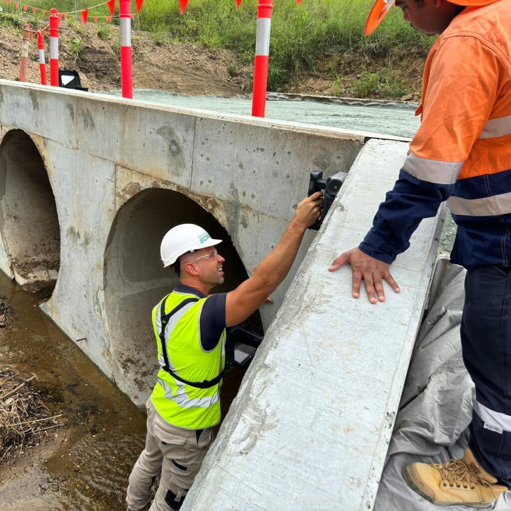
- Ground-penetrating radar (GPR): Uses electromagnetic waves to produce images of subsurface features. GPR excels at detecting non-metal objects (plastic pipes, voids) and gives depth information.
- Covermeters / rebar detectors (electromagnetic): Designed to find metallic reinforcement and measure concrete cover. Fast and effective for steel detection.
- X-ray / radiography: Extremely accurate for locating embedded steel and objects, but requires strict safety controls and is less common on routine building sites.
Often, a competent scanning provider will use a combination of GPR and electromagnetic detectors to cross-check findings. That redundancy improves both positional and identification accuracy.
Typical accuracy ranges
Exact accuracy depends on many variables (see below), but some practical expectations are:
- Positional accuracy (horizontal): In good conditions, professional GPR and covermeter surveys commonly achieve ±10–30 mm (1–3 cm) horizontal accuracy for detectable objects. Combining methods and expert interpretation can improve confidence.
- Depth accuracy (vertical): For GPR, depth estimates are typically ±10–30% of the reported depth — so a target reported at 100 mm depth might actually be between ~70–130 mm, depending on concrete conditions and calibration. Electromagnetic covermeters report cover more precisely for steel but can have reduced accuracy with deep or congested reinforcement.
- Identification confidence: With clear signals, classification (steel vs non-steel, void vs soil) can be highly reliable. But when targets overlap, are deeply buried, or signal quality is poor, identification becomes ambiguous and may require verification (trial hole or coring).
These figures are practical rules of thumb — not guarantees. A reputable scanner will report confidence levels and recommend verification where needed.
What affects accuracy?
Several factors influence how accurate a scan can be:
- Concrete composition and moisture: High moisture content or conductive aggregates change signal propagation for GPR and can blur images.
- Rebar congestion: Dense reinforcement can mask underlying features or create complex reflections.
- Depth of the target: Accuracy typically decreases with depth; very deep objects may be undetectable or imprecisely located.
- Target size and material: Small or non-metallic objects return weaker signals.
- Surface condition and access: Scanners need good contact and consistent movement across the surface. Rough surfaces, obstacles or restricted access reduce data quality.
Calibration and interpretation: Proper calibration (e.g. velocity calibration for GPR) and an experienced operator interpreting the data are essential. Raw data without expert interpretation can be misleading.
Best practice to maximise accuracy
To get the most reliable results from concrete scanning:
1
Provide site drawings and service records where available — these give the scanner context and can speed up interpretation.
2
Allow time for a proper survey. Rushed scans or “quick checks” reduce accuracy and increase risk.
3
Use combined methods. GPR plus electromagnetic detection is the industry standard for thorough surveys.
4
Mark and photograph findings clearly. Durable marks and a site map reduce human error when crews act on the data.
5
Verify critical findings. For high-risk penetrations, cores or trial holes are a small extra cost compared with the expense and danger of hitting a service. South-East Scanning will advise when verification is recommended.
6
Keep a record. Deliverables should include annotated plans, depth estimates, signal screenshots and a brief report stating limitations and confidence.
Limitations you should know about
No scanning method is infallible. Expect your scan report to include a limitations section that explains detectable depths, possible blind spots, and the operator’s level of certainty. For example:
- Plastic conduits under heavy steel may be partially obscured.
- Very shallow or very deep objects can be mislocated.
- Complex service networks may require staged scanning and/or trial holes.
Being upfront about limitations is part of responsible surveying.
Real-world examples
- A renovation team relied solely on as-built drawings and hit a conduit. A combined GPR + covermeter survey before cutting would likely have detected the discrepancy.
- A contractor coring for new anchors used a scan that located rebar clusters to ±15 mm — the core missed rebar every time, proving the scan’s accuracy and saving time.
Choosing the right provider
When selecting a scanning company, ask:
- What technologies do you use and why?
- Can you provide sample reports and references?
- Do you mark up findings on durable paint and supply digital plans?
- Will you state the confidence level and limitations in writing?
- Are your operators trained and experienced?
Conclusion
Concrete scanning technology is highly accurate when used correctly. In practical, professional settings, you can expect horizontal positional accuracy in the order of a few centimetres and depth estimates that are useful for safe decision-making. Accuracy improves when different technologies are combined, operators calibrate equipment on site, and results are verified for critical penetrations.
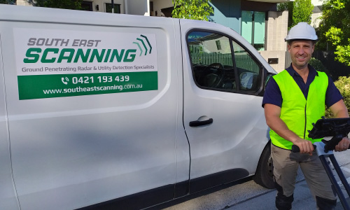
At South-East Scanning we combine GPR and electromagnetic detection, calibrate on site, and deliver clear, annotated plans with confidence statements so your team can proceed safely and efficiently. If you’ve got a slab, wall or structure you need to work on, contact us for a survey — we’ll explain what we can detect, how accurate it will be for your job, and whether verification should be included.