Client: ARCOS
Location: Dalby, QLD
Date: June–July 2024
Equipment Used: IDS Stream C GPR, RTK GNSS, Geolitix Software
Project Background
South-East Scanning was engaged by ARCOS to conduct a large-scale ground penetrating radar (GPR) survey across an expansive industrial site in Dalby, Queensland. The survey was part of a major infrastructure investigation aimed at mapping subsurface utilities, pavement layers, and structural anomalies across a development zone with minimal existing records.
Dalby’s location in the Darling Downs makes it geologically and logistically challenging — with clay-heavy soils, inconsistent backfill, and legacy infrastructure often buried without documentation.
Scope of Work
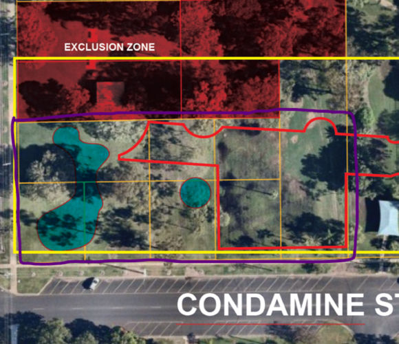
The scope was extensive and included:
- Full-width scanning of paved and unpaved surfaces
- Detection and mapping of utilities, trenches, stormwater assets, and other buried infrastructure
- Identification of any subsurface inconsistencies or anomalies that could impact future excavation, design, or construction
The goal was to deliver a high-resolution, spatially accurate dataset that could be used for both design and risk management across multiple disciplines.
Methodology
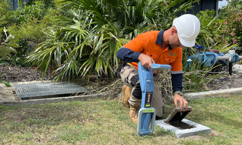
To meet the technical demands of this project, South-East Scanning deployed the IDS Stream C, a high-performance multi-array GPR system capable of rapid, wide-area data acquisition.
The methodology included:
- RTK GNSS integration via survey-grade Emlid Reach RS2 receivers to ensure geospatial accuracy
- Collection of overlapping swaths to ensure full surface coverage, even over uneven terrain
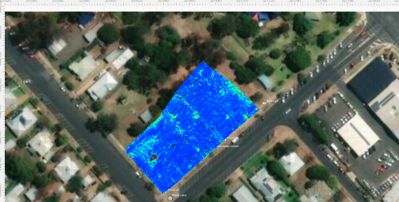
- Post-processing using Geolitix, generating time-sliced heatmaps, B-scan cross-sections, and anomaly classifications
- Export of deliverables in multiple formats to suit GIS, CAD, and engineering workflows
Findings
The processed radar data yielded a comprehensive view of the subsurface environment. Key findings included:
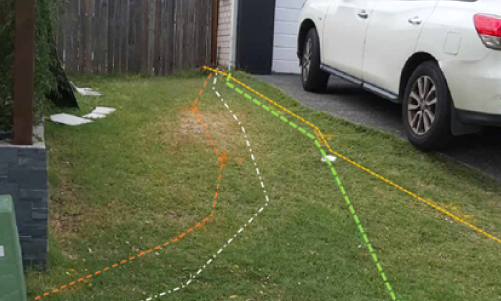
- Clear delineation of buried trench lines consistent with undocumented services
- Areas of differential compaction that could suggest fill variability or historical excavation
- Multiple utilities crossing beneath hardstand areas, some with no associated surface indications
These findings were delivered in a structured report with interactive mapping outputs, allowing ARCOS to integrate the results into broader design and risk assessment processes.
Outcome and Recommendations
The Dalby project showcased South-East Scanning’s ability to execute large-scale, multi-day GPR surveys with high-resolution outputs and rapid turnaround. By providing ARCOS with accurate and actionable data, the survey:
- Prevented potential utility strikes during early works
- Identified undocumented services for further investigation
- Enhanced planning confidence across multiple stakeholders
We recommended ground truthing of key anomalies using potholing or hydro-vac prior to final civil design, especially in trench-dense regions.
Project Highlights
- Multi-day mobilisation covering a large industrial site footprint
- High-resolution data delivered despite challenging clay conditions
- Fully georeferenced deliverables compatible with GIS and CAD
- Demonstrated value of IDS Stream C for regional infrastructure development projects
Need a hand with your project? We can help you. Contact our team at South East Scanning!