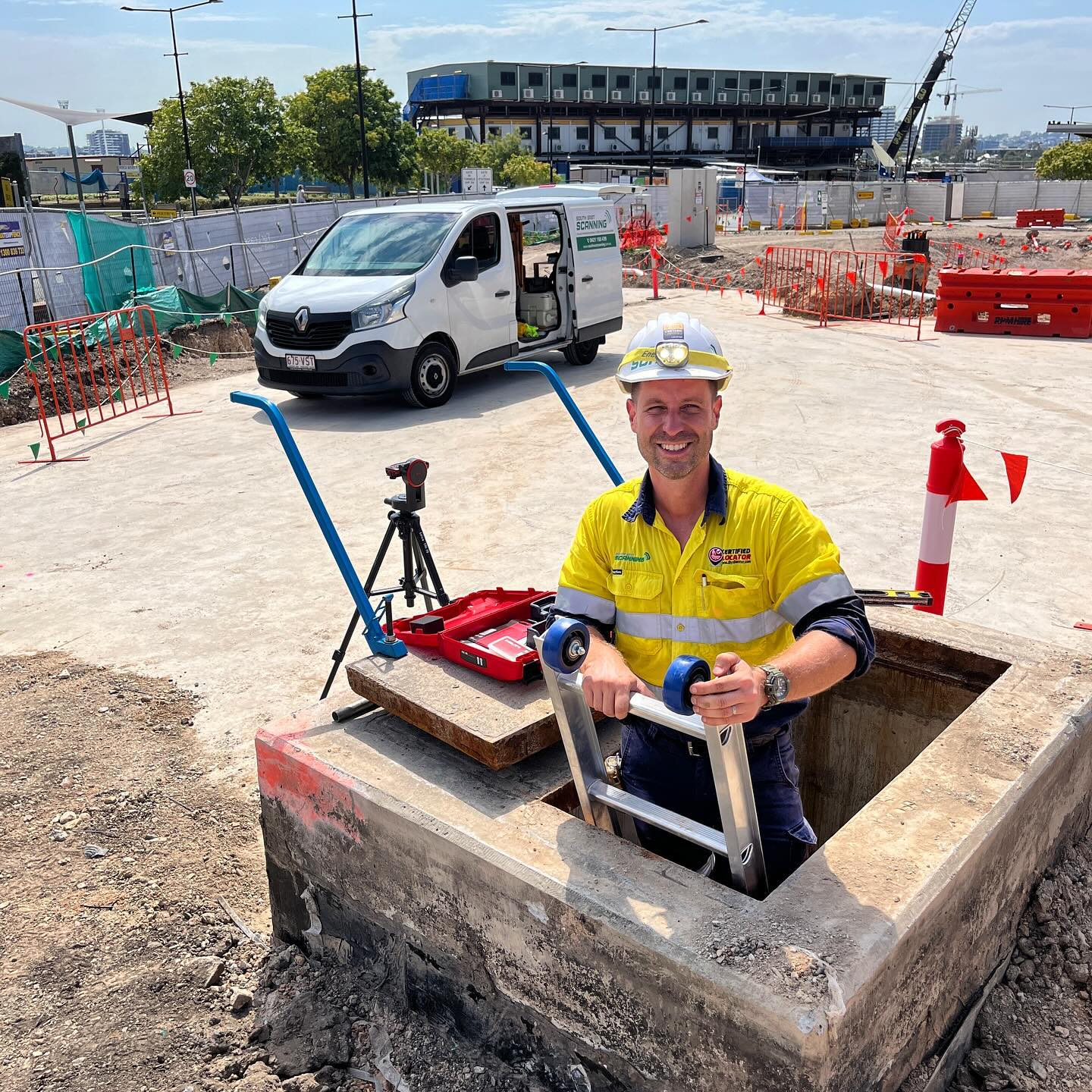
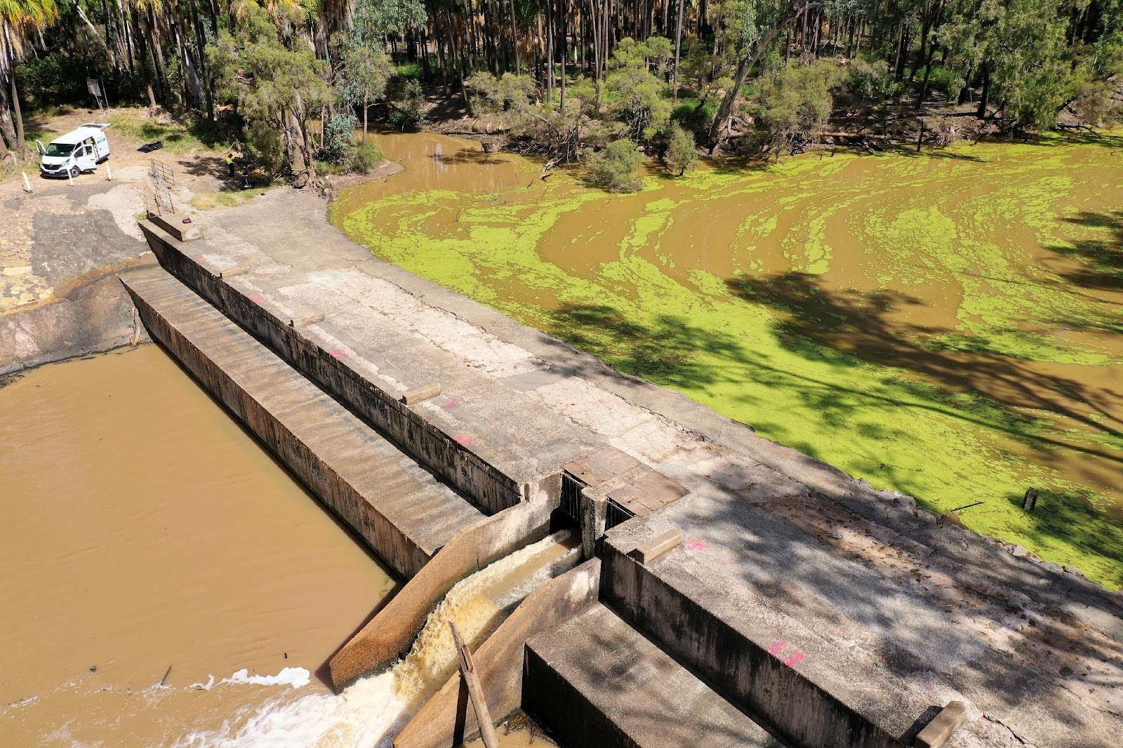
South-East Scanning was commissioned to perform a comprehensive geophysical survey of the Orange Creek Weir, located west of Barcaldine in Central Queensland. The structure had shown signs of surface cracking and water erosion, raising concerns over possible internal voiding and structural deterioration. Our team was called in to deliver a high-resolution ground penetrating radar (GPR) survey to assist council engineers in making evidence-based decisions regarding the safety and maintenance of the weir.
Our Objective: Structural Integrity and Void Detection Survey
Orange Creek Weir
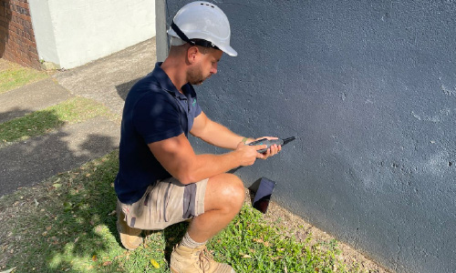
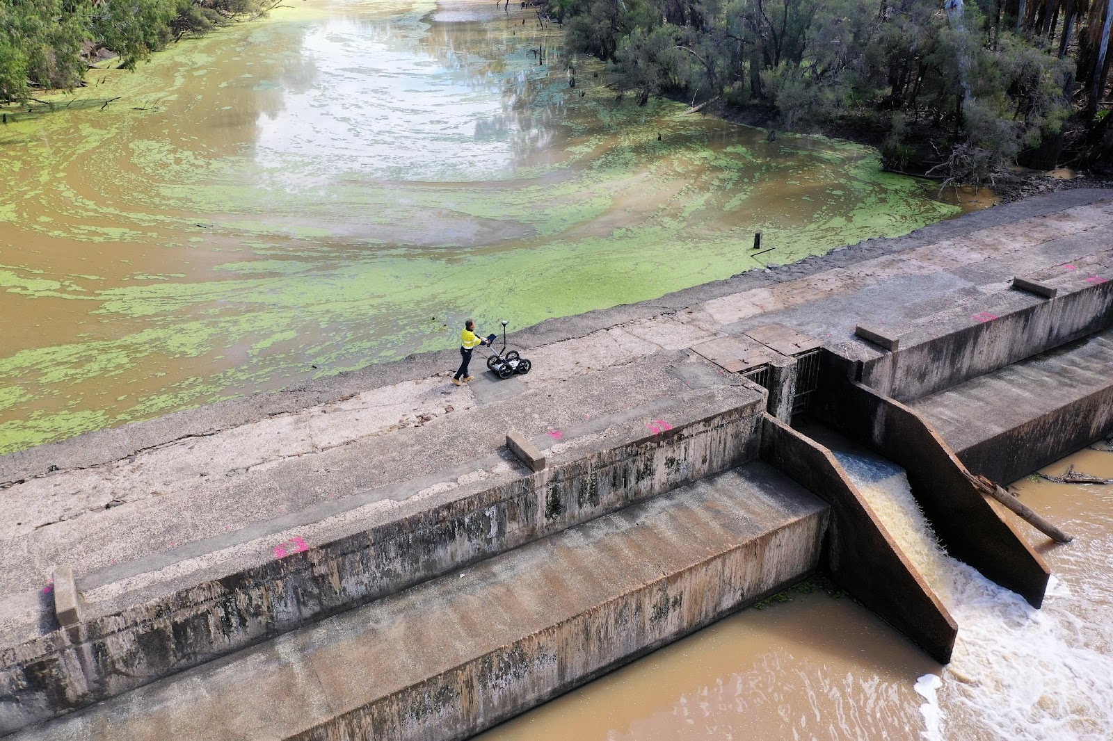
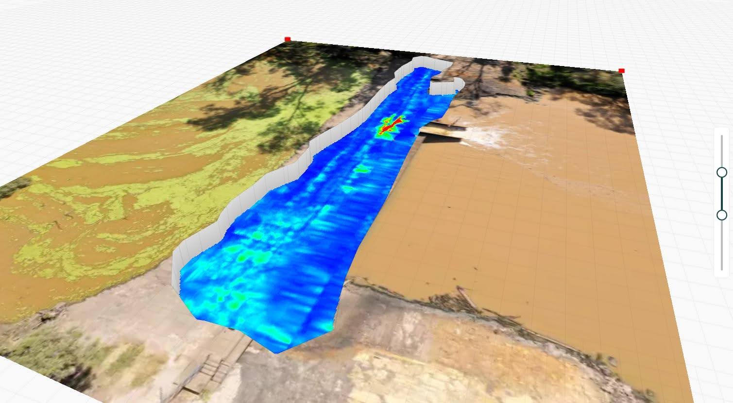
To undertake this investigation, we used the **Mala GX160MHz GPR system**, a powerful low-frequency radar ideal for penetrating thick concrete and identifying large-scale subsurface anomalies. The survey was coordinated with an **Emlid Reach RS2 RTK-GNSS system**, allowing all scan data to be spatially referenced and accurately mapped for 3D interpretation. This configuration enabled us to capture deep reflections across the full width of the structure — from abutment to abutment — while working under difficult conditions near the spillway edge.
The site posed a number of challenges, including uneven terrain, active water flow, and inaccessible upstream and downstream faces. However, our equipment was deployed with precision and stability, enabling continuous data acquisition across all accessible surfaces. The scanning grid covered the entire width of the weir crest with transects spaced approximately 600 mm apart.
Post Processing
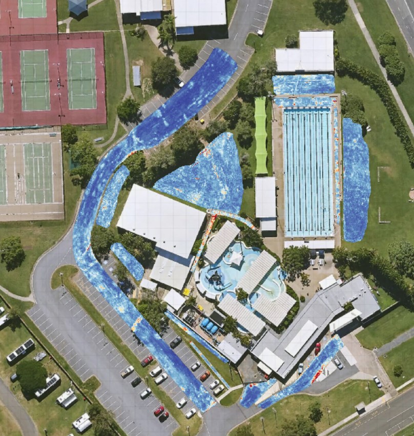
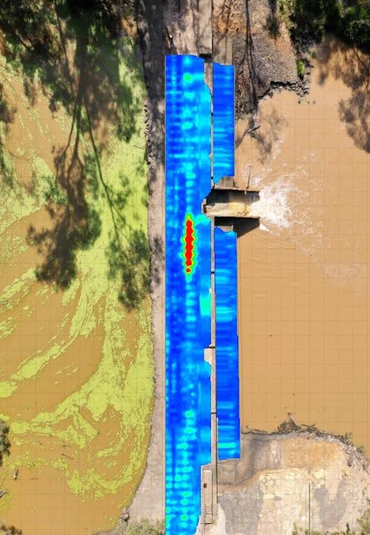
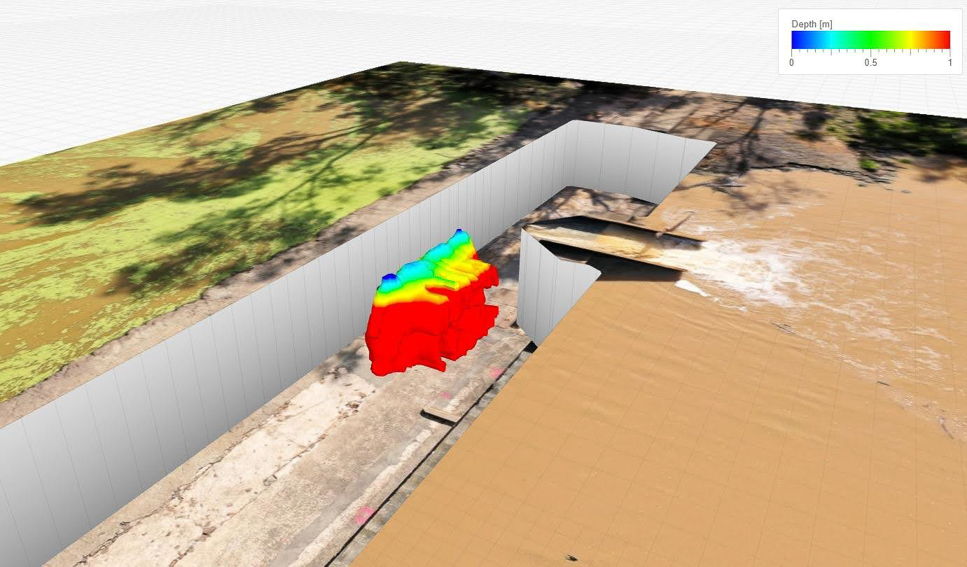
Post-processing was conducted in **Geolitix**, where we leveraged its volumetric slicing tools to identify several key anomalies. Most notably, a large high-amplitude reflection zone was discovered in the centre of the structure, aligned with visible cracking on the surface. This was interpreted as a potential void or area of significant internal degradation. The anomaly’s geometry and contrast stood out clearly in 3D slice views and cross-sectional plots, providing compelling evidence for further structural investigation.
Deliverables included
- High-resolution heatmaps of amplitude reflection patterns
- Full 3D model of internal structure with depth layering
- Drone orthophotos and GPR overlays for visual reference
- A written interpretation with mapped anomaly coordinates
Outcome
Our findings allowed local engineers to move from speculation to certainty. The anomaly was flagged for immediate attention and incorporated into a repair and monitoring program. The data provided by South-East Scanning not only confirmed suspicions of internal damage, but provided visual and measurable justification for urgent remediation planning.
