Coastal regions offer some of the most breathtaking landscapes and vital infrastructure, from bustling harbours and beachfront properties to bridges and seawalls. However, when it comes to ground-penetrating radar (GPR) scanning, coastal environments present unique challenges that can impact scanning accuracy.
High salt content, moisture levels, sandy soil conditions, and fluctuating water tables can interfere with GPR signals, making it more challenging to detect underground utilities, reinforcement in concrete, or subsurface voids.
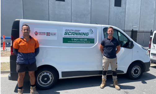
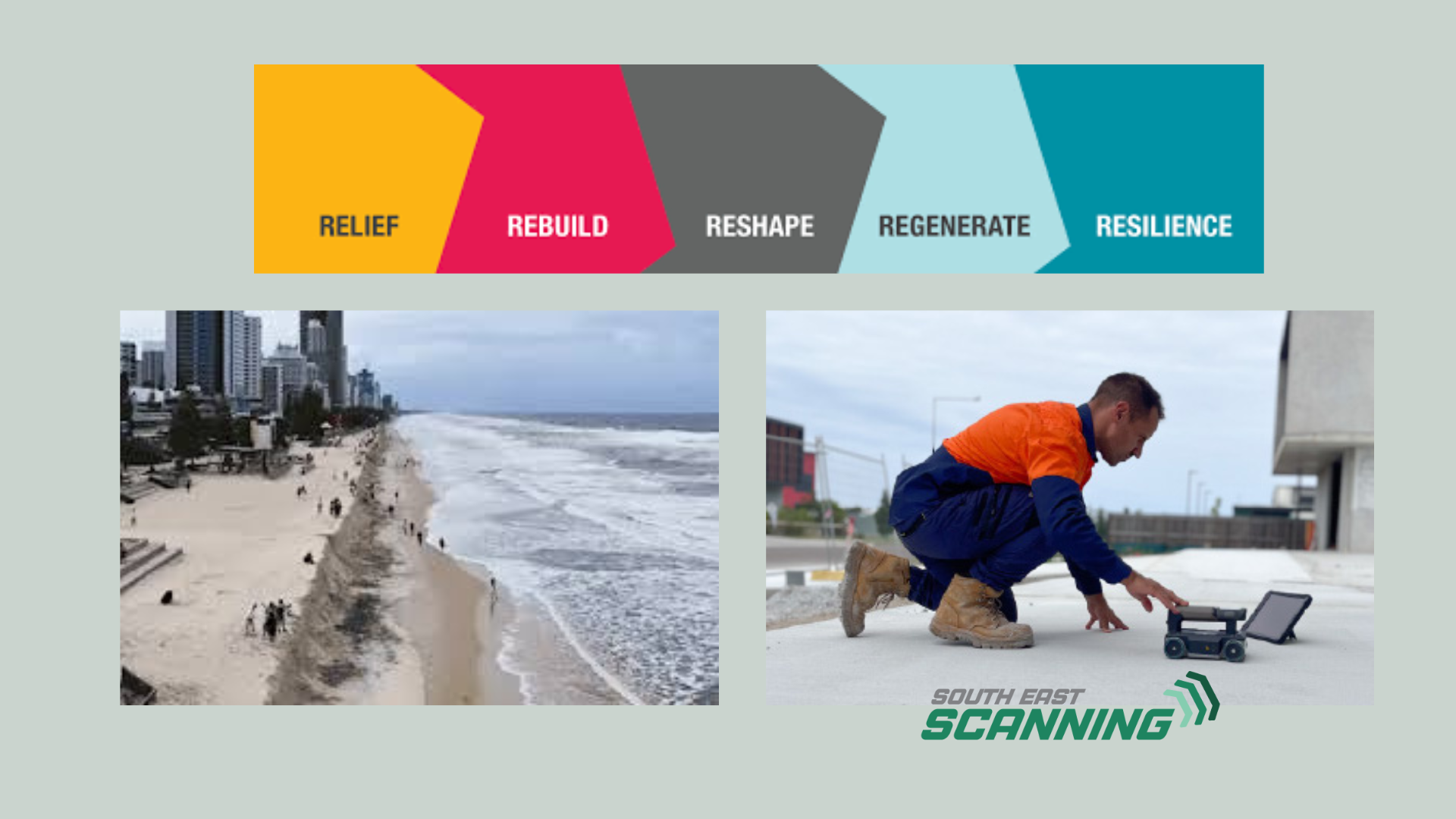
At South-East Scanning, we’ve worked extensively in Brisbane, the Sunshine Coast, and other coastal areas, fine-tuning our approach to deliver precise and reliable GPR scans despite these environmental obstacles. Here’s a look at the challenges of GPR scanning in coastal regions and how they can be effectively overcome.
1. The Challenge: High Moisture Levels Affect Signal Penetration
At South-East Scanning, we’ve worked extensively in Brisbane, the Sunshine Coast, and other coastal areas, fine-tuning our approach to deliver precise and reliable GPR scans despite these environmental obstacles. Here’s a look at the challenges of GPR scanning in coastal regions and how they can be effectively overcome.
⚠ Weaker or distorted signals
⚠ Reduced scanning depth
⚠ Potential loss of detail in deeper scans
How to Overcome It:
✅ Use higher-frequency antennas for shallow scans where moisture is present.
✅ Adjust scan settings to compensate for signal attenuation (loss of radar strength).
✅ Perform scans during drier conditions when possible.
2. The Challenge: High Salt Content Interferes with Signal Clarity
Coastal soil and concrete structures near the ocean contain high levels of salt, which can significantly impact GPR performance. Salt is highly conductive and can cause:
⚠ Signal scattering, making data more challenging to interpret.
⚠ Stronger attenuation, reducing how deep the radar can penetrate.
This is particularly challenging when scanning coastal roads, seawalls, and marinas, where salt exposure is highest.
How to Overcome It:
✅ Use lower-frequency antennas for deeper penetration where needed.
✅ Implement signal processing techniques to filter out background noise.
✅ Complement GPR with other scanning technologies like electromagnetic locating (EML) for enhanced accuracy.
3. The Challenge: Sandy and Loose Soil Conditions Impact Accuracy
Many coastal regions, including parts of Brisbane and the Sunshine Coast, have sandy, loose soil that behaves differently than clay or compacted urban ground. The challenges include:
⚠ Lower contrast between materials, making it harder to distinguish underground features.
⚠ Unstable subsurface layers, which may shift over Time and alter results.
How to Overcome It:
✅ Conduct multi-directional scans (scanning in multiple orientations to improve accuracy).
✅ Adjust data interpretation techniques to account for shifting soil layers.
✅ Consider repeat scanning over Time to track subsurface changes caused by erosion.
4. The Challenge: Tidal Influence and Fluctuating Water Tables
In many coastal locations, especially low-lying areas, the water table can fluctuate with the tides. A rising water table affects GPR signals similarly to regular moisture – by reducing penetration and signal clarity.
This can be particularly problematic for:
⚠ Infrastructure projects near the shoreline (bridges, retaining walls, and marinas).
⚠ Drainage assessments, where underground water movement must be mapped accurately.

How to Overcome It:
✅ Time scans around low tide whenever possible for better results.
✅ Combine GPR with other hydrogeological assessment tools for a complete picture.
✅ Use higher-frequency antennas for surface-level mapping, where deeper penetration isn’t needed.
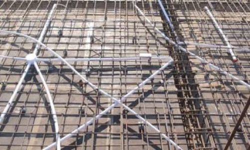
5. The Challenge: Corrosion in Concrete Affects Reinforcement Mapping
Coastal environments accelerate corrosion in concrete due to exposure to salty air, high humidity, and water infiltration. This can impact GPR scanning by:
⚠ Altering the reflectivity of embedded reinforcement (e.g., rusted rebar may appear weaker in scans).
⚠ Introducing cracks and voids that affect signal consistency.

How to Overcome It:
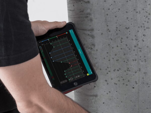
✅ Use high-resolution GPR scanners like the Proceq GP8000 to detect corroded reinforcement.
✅ Complement GPR with cover meters (like the Proceq Profometer PM8000) to verify reinforcement conditions.
✅ Regularly monitor high-risk structures with periodic GPR inspections to detect early signs of corrosion.
How South-East Scanning Delivers Accurate GPR Results in Coastal Areas
At South-East Scanning, we understand the complexities of GPR scanning in challenging coastal environments. Our team has extensive experience adjusting scanning methods for moisture levels, salt interference, sandy soils, and fluctuating water tables.
Our approach includes:
✔ Advanced GPR technology – We use high-resolution systems allowing deeper, more accurate scans.
✔ Expert calibration – Adjusting frequencies, signal filtering, and scan angles for maximum clarity.
✔ Multi-technology integration – Combining GPR, electromagnetic locating (EML), and cover meters for a comprehensive subsurface picture.
✔ Strategic scheduling – Planning scans at optimal times (e.g., low tide, dry conditions) for better results.
Our work across Brisbane, the Sunshine Coast, and regional Queensland has helped engineers, construction teams, and councils safely map utilities, reinforcement, and voids without compromising accuracy.
Conclusion
GPR scanning in coastal environments has unique challenges, but these obstacles can be overcome with the right technology, expertise, and strategic approach. By adapting to high moisture levels, salt interference, sandy soils, and fluctuating water tables, GPR remains a powerful tool for non-destructive testing in coastal construction, infrastructure maintenance, and flood prevention.
At South-East Scanning, we are dedicated to delivering precise, reliable scanning solutions – even in the most demanding environments.
Do you need accurate GPR scanning for your coastal project? Please reach out to us today to learn how we can help you quickly navigate the challenges of subsurface mapping.
🔍 Precision. Expertise. Coastal-Ready Scanning. 🌊
Ensure accurate GPR scanning in coastal areas—contact South-East Scanning today for a Free Quote and reliable subsurface mapping!