Beyond concrete and conduits: What most people don’t realise about ground-penetrating radar (GPR)
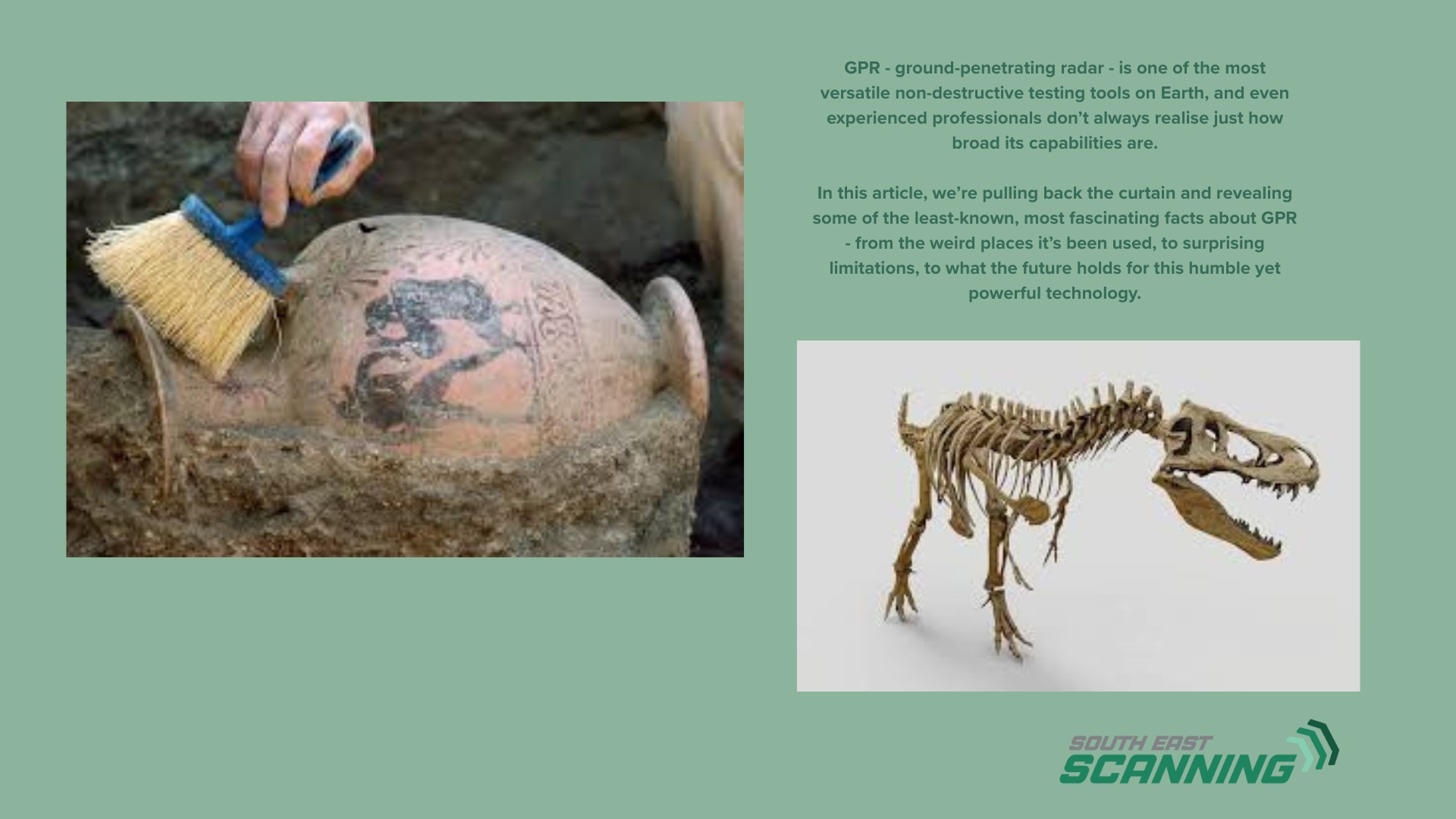
At South-East Scanning, we’re used to being called in for concrete scanning, utility locating, and void detection under warehouse slabs. But GPR – ground-penetrating radar – is one of the most versatile non-destructive testing tools on Earth, and even experienced professionals don’t always realise just how broad its capabilities are.
In this article, we’re pulling back the curtain and revealing some of the least-known, most fascinating facts about GPR – from the weird places it’s been used, to surprising limitations, to what the future holds for this humble yet powerful technology.
1. GPR Can Detect Things You’d Never Expect - Even Graves and Dinosaur Bones
GPR is often thought of as an engineering tool – but archaeologists, forensic teams, and palaeontologists are also major users of the technology. It’s especially valuable in heritage contexts where excavation is prohibited or would cause irreversible damage.
- In fact, GPR has been used to:
- Map ancient graveyards without disturbing human remains
- Detect dinosaur fossil beds embedded deep in sediment layers
- Search for mass graves or clandestine burials in forensic investigations
- Identify buried cultural artefacts, pottery, and ruins
2. GPR Doesn’t Work Well in Wet Clay or Saltwater Soils — Here’s Why
One of the most common misconceptions is that GPR can see through anything. That’s not quite true. GPR works by sending high-frequency radio waves into the ground and recording how they bounce back. These waves interact differently depending on the material, and some materials don’t play well with others.
· Wet clay, for example, has a very high dielectric constant and absorbs radar energy quickly.
· Saltwater-saturated soils, like those near the coast (hello, Gold Coast and Sunshine Coast), create high conductivity environments where radar waves are heavily attenuated.
· Reinforced concrete slabs with surface-mesh reinforcement can create signal reflections that mask deeper features.
The takeaway? GPR is powerful – but it’s not magic. Site conditions matter, and experienced operators know when to pair it with electromagnetic (EM) locators or sonar.
3. GPR Was Originally Developed for Ice Detection - Not Utilities
The earliest uses of GPR weren’t about finding pipes or post-tension cables. In the 1960s and 70s, scientists used radar to study glaciers and ice thickness in polar regions. It was only later that the construction and civil engineering industries realised its value for mapping artificial structures.
Fun fact: NASA has used GPR on planetary rovers to study subsurface features on the Moon and Mars.
From the icy poles to outer space, GPR’s evolution is a testament to its adaptability – and it’s only getting better.
4. You Can’t Identify a Utility’s Material with GPR Alone
Another misconception: that GPR can tell you what you’re scanning – not just where it is.
While GPR shows you reflections caused by changes in material density, it doesn’t tell you what the object is made of. Is that signal a PVC pipe? Fibre optic? Metal conduit? Unless you have additional data — such as electromagnetic detection or known plans – GPR alone can’t distinguish materials.
5. GPR Can Be Used on Walls, Ceilings, and Even Underwater
Think GPR only works on the ground? Think again.
- GPR units can be mounted vertically to scan walls or bridge columns for delamination or voids.
- It’s used to scan tunnel linings for moisture ingress.
- Some radar systems have been custom-adapted for shallow underwater surveys, though performance is limited.
Whether it’s a heritage-listed wall in Brisbane CBD or a seawall in a coastal marina, GPR’s form factor and antenna options make it surprisingly flexible.
6. GPR is Becoming Smarter - Thanks to AI and Machine Learning
Modern GPR systems don’t just collect data — they’re learning to interpret it too. Advanced platforms are beginning to integrate:
- AI-powered anomaly detection, helping highlight unusual signatures automatically
- Automated feature extraction, reducing post-processing time
- 3D visualisation, making data more accessible for engineers and clients
This is part of the GPR revolution: more innovative tools, faster results, and more intuitive visualisations, even for non-technical stakeholders.
7. GPR Data Can Be Georeferenced for Use in CAD, BIM, and GIS
Many people think of GPR as a point-in-time scan – but with the proper GNSS setup and control points, scans can be accurately georeferenced. That means:
- You can import GPR findings into AutoCAD, QGIS, or BIM models
- Site managers and engineers can overlay utility data on building plans or asset registers
- Longitudinal scans (like railway ballast or airport runways) can be mapped in real-world coordinates
For large infrastructure projects in South-East QLD, this geospatial layer adds significant value.
Final Thought: There’s More to GPR Than Meets the Eye
From ancient ruins to cutting-edge AI, GPR is one of the most fascinating, underappreciated technologies in the built environment.
At South-East Scanning, we’ve seen firsthand how GPR can solve problems that would otherwise lead to costly surprises – or missed opportunities. Whether we’re scanning a retaining wall in Herston, tracing abandoned stormwater drains under a shopping centre, or mapping potential voids before a concrete pour – we’re constantly surprised by how useful GPR can be.
The key? Knowing when, where, and how to use it – and how to interpret the story it tells beneath the surface.