In recent years, the rise of drone technology has transformed various industries, and surveying is no exception. The ability to collect high-resolution data quickly, safely, and efficiently has made drone surveying an invaluable tool across multiple sectors. South East Scanning, a leading surveying company, understands the immense potential of drone technology to streamline surveying processes, reduce costs, and improve accuracy. Below, we explore the top uses of drone surveying and how it is revolutionising the industry.
1. Topographical Surveys
One of the most common uses of drone surveying is for topographical surveys. These surveys are critical in mapping out the land’s features, such as elevation, slopes, and vegetation. Traditional land surveys often require surveyors to manually traverse the site, which can be both time-consuming and physically demanding. Drones, however, can capture detailed aerial imagery and generate 3D models of the landscape.
Drones equipped with LiDAR (Light Detection and Ranging) technology can also provide highly accurate data about the terrain, including hard-to-reach areas such as steep slopes and dense vegetation. This data can be used for urban planning, construction, and environmental studies. For businesses like South East Scanning, drone topographical surveys offer enhanced efficiency and precision, making them a preferred method for land assessment.
2. Construction Site Monitoring
Construction projects often span large areas, and keeping track of the progress can be challenging. Drone surveying has become an indispensable tool for monitoring construction sites, providing up-to-date aerial imagery that helps project managers, contractors, and stakeholders assess the project’s status in real-time.
Drones can capture aerial images and videos regularly, allowing for visual inspections of the entire site. This helps identify potential issues early, such as delays, safety hazards, or areas that require attention. Additionally, drone surveys can be used to create as-built models of the site, ensuring that construction follows the approved plans.
3. Agricultural Land Assessment
Drone surveying is proving to be incredibly beneficial in the agriculture sector. Farmers and landowners can use drones to assess large tracts of land quickly and accurately. Drones equipped with multispectral cameras can capture data on soil health, crop conditions, and irrigation needs. This information is then used to optimise farming practices, improve crop yields, and reduce waste.
For example, drones can identify areas where crops are underperforming due to lack of water or pest infestations. Farmers can then target these areas for treatment, reducing the use of chemicals and water, leading to cost savings and improved environmental sustainability.

4. Environmental Monitoring and Conservation
Drone allow environmentalists, ecologists, and conservationists to monitor vast areas of land, forests, wetlands, and coastlines in a fraction of the time it would take using traditional methods.
By using drones, it’s possible to assess the health of ecosystems, track the movement of wildlife, and even measure the effects of climate change. Drones are often used in conservation efforts to study endangered species, monitor deforestation, or gather data on the effects of pollution.
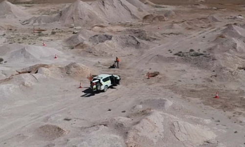
5. Mining and Quarry Surveys
Mining operations require extensive surveying to assess the volume of materials available, monitor stockpiles, and ensure compliance with regulations. Drone surveying has significantly reduced the time required to carry out these tasks, as well as improved the accuracy of data collection.
Drones can quickly map out large mining areas, capturing 3D models of the terrain and stockpiles. This data can be used to estimate the volume of extracted materials, helping mining companies manage inventory and assess excavation progress. LiDAR-equipped drones are particularly effective in this sector as they can map the surface with high accuracy, even in areas with difficult terrain.
6. Inspection of Infrastructure and Utilities
Inspecting infrastructure such as bridges, power lines, towers, and other large structures can be a dangerous and time-consuming task for workers. Drone surveying provides a safer, more efficient alternative, allowing inspectors to gather visual data without the need for scaffolding, ladders, or climbing.
Drones are equipped with high-resolution cameras and thermal imaging sensors, enabling them to inspect and monitor infrastructure in detail. They can detect issues such as cracks, corrosion, or leaks, which can then be addressed before they escalate into costly repairs or safety hazards.

7. Flood Risk Assessment and Management
Flood risk assessment is a critical component of urban planning and environmental management. Traditional methods of assessing flood-prone areas often involve extensive fieldwork, which can be both expensive and time-consuming. Drones provide an alternative by capturing aerial imagery and generating accurate 3D maps of floodplains.
Drones can be used to model how water flows across a landscape, identify flood risks, and plan for future flood mitigation. By capturing data in real-time, drone surveys can also help track the effects of flooding during extreme weather events, providing valuable insights for emergency response teams.
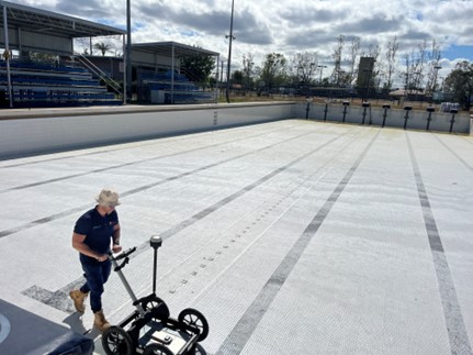
8. Volumetric Measurements for Stockpile Management
Accurate volumetric measurements are critical for industries like mining, construction, and agriculture, where stockpiles of materials must be regularly assessed. Traditional methods of measuring stockpiles can be labour-intensive and prone to human error. Drones can quickly and accurately measure the volume of stockpiles by capturing high-resolution images from different angles and using photogrammetry to create detailed 3D models.
These volumetric models provide businesses with precise data to manage inventory and improve supply chain operations. This approach not only saves time but also enhances the accuracy of stockpile management, making it an essential tool for companies managing large quantities of materials.
Conclusion
Drone surveying is transforming the way industries approach land assessment, monitoring, and data collection. With applications in construction, agriculture, environmental conservation, mining, infrastructure inspection, flood management, and stockpile management, drones offer unmatched efficiency, accuracy, and safety. South East Scanning is at the forefront of this innovation, providing expert drone surveying services tailored to meet the unique needs of each client.
If you’re looking to enhance your surveying capabilities and embrace the future of data collection, contact South East Scanning today. Let our team of experts help you streamline your operations, reduce costs, and make more informed decisions with drone technology.
Get in touch with South East Scanning now for a consultation and see how our drone surveying services can benefit your business!