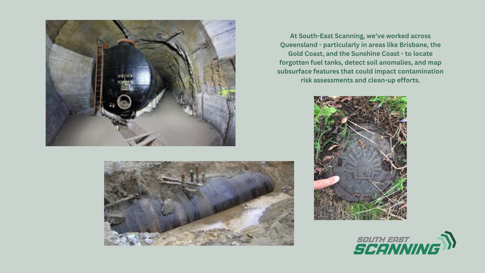
In the world of environmental investigation and remediation, one rule stands above all: you can’t fix what you can’t find. Whether it’s an old service station, a decommissioned industrial site, or a future development block with a mysterious history, underground storage tanks (USTs) and soil contamination are risks that need early identification. And in many cases, they’re hiding just beneath the surface -invisible to the naked eye and missing from site records. That’s where Ground Penetrating Radar (GPR) is proving to be a game-changer for environmental consultants, geotechnical engineers, and remediation specialists. At South-East Scanning, we’ve worked across Queensland - particularly in areas like Brisbane, the Gold Coast, and the Sunshine Coast - to locate forgotten fuel tanks, detect soil anomalies, and map subsurface features that could impact contamination risk assessments and clean-up efforts.
🛢️ The Problem with Forgotten Fuel Tanks and Contaminated Sites
From the 1950s through the early 2000s, thousands of properties across Australia installed steel underground storage tanks to store fuel, chemicals, or other volatile liquids. Many of these tanks were never properly decommissioned. Over time, they corrode, collapse, or leak – releasing toxic substances into surrounding soil and groundwater.
Unfortunately, because many of these tanks were installed decades ago, property records are incomplete, and former owners are long gone. The result? Environmental consultants today are left with uncertainty, liability, and time-sensitive decisions.
Visual inspection won’t reveal what’s underground. And drilling blindly risks damage to tanks, utilities, and the environment. This is where non-invasive subsurface scanning using GPR makes all the difference.
How GPR Detects Underground Storage Tanks (USTs)
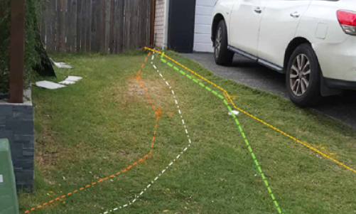
Ground Penetrating Radar works by emitting high-frequency radar waves into the ground and recording the signals that bounce back. Different materials – soil, metal, concrete, water, or voids – reflect radar waves differently, creating a unique “signature” on the scan.
Buried tanks typically appear as strong, hyperbolic reflections on the radargram. Even if a tank is collapsed or partially filled, the shape and contrast still allow a trained GPR technician to identify anomalies with a high degree of confidence.
- GPR can also detect:
- Associated fuel lines or conduits
- Concrete tank collars or access points
- Anomalies in the soil structure (suggesting past excavation or contaminated fill)
- Voids or sinkholes resulting from collapsed tanks
- Leachate plume patterns in some conditions
When combined with site control points, utility records, and geophysical overlays, GPR gives consultants a reliable subsurface picture – without the cost or risk of excavation.
Soil Contamination Clues and GPR
While GPR cannot directly “see” contaminants like hydrocarbons or heavy metals, it can identify disturbed soil zones, changes in material density, and water table anomalies that suggest a problem area. Environmental teams then use this data to target borehole drilling and soil sampling more effectively.
- This makes GPR a valuable first step in Phase I and Phase II Environmental Site Assessments, helping teams:
- Focus remediation budgets
- Reduce unnecessary exploratory drilling
- Avoid damage to unknown utilities or tanks
- Build a risk profile for future development or acquisition
Real-World Applications
Former Service Station, Brisbane
Recently, our team at South-East Scanning was engaged to scan a former petrol station site in inner Brisbane. Records were incomplete, but the client needed to confirm whether USTs remained before redevelopment.
Using a 400 MHz GPR antenna, we scanned the site in a tight grid, identifying two buried cylindrical anomalies at approximately 1.2 m depth – each consistent with the size and orientation of 5,000-litre tanks. One of the tanks had already begun collapsing inward.
Because of our scan, the environmental consultant was able to prioritise that area for test pits and sampling, confirm the presence of hydrocarbon-impacted soil, and develop a compliant remediation strategy – all without unnecessary excavation or guesswork.
Why Environmental Consultants Rely on GPR
Buildings in coastal regions like the Sunshine Coast face increased risk due to constant exposure to salt-laden air and high humidity. Salt accelerates the corrosion of embedded steel, making early detection even more critical in these environments. GPR is beneficial here because it helps detect damage in high-risk zones (balconies, podiums, retaining walls, etc.) without requiring intrusive testing.
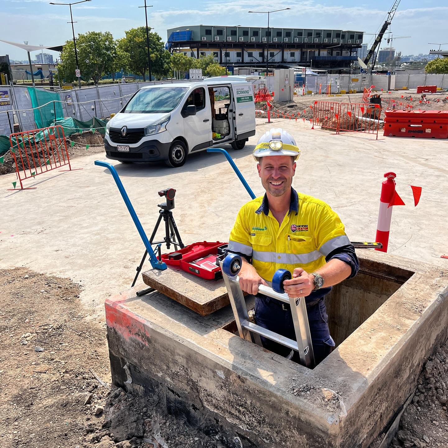
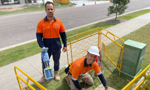
How South-East Scanning Can Help
At South-East Scanning, we specialise in high-resolution, geolocated GPR scans for environmental and geotechnical applications. We work alongside consultants to provide:
- Grid scans and anomaly mapping
- GNSS integration for accurate reporting
- Utility locating to avoid service strikes during remediation
- Clear, actionable data formatted for your reports
We’ve supported projects across Brisbane, the Gold Coast, and Sunshine Coast – from service station closures to legacy industrial clean-ups – and we’re ready to support your next site investigation.
Final Thoughts
When environmental risk is buried underground, time is of the essence. GPR scanning is your early-warning system, helping locate what others can’t see and ensuring safe, cost-effective remediation strategies.
Before you dig, drill, or demolish – let’s take a look beneath the surface.
📞 Ready to map out your next environmental investigation with confidence? Reach out to South-East Scanning today.
#EnvironmentalConsulting
#GPRTechnology
#UndergroundStorageTanks