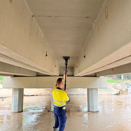
South-East Scanning was engaged by Eptec Pty Ltd to perform a ground-penetrating radar (GPR) survey beneath the Indooroopilly Bridge in Chelmer, Queensland. The aim was to evaluate the extent of soil washout and its potential impact on the stability of the bridge and adjacent riverbank, particularly after significant rainfall.
Methodology
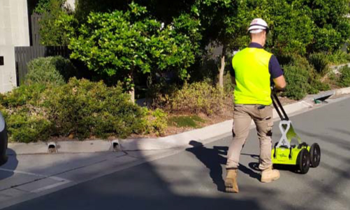
Utilising the Impulse Radar PinPointR and Leica DS2000, the team employed dual-frequency GPR scanning (400MHz & 800MHz) to penetrate the subsurface. This approach allowed for an in-depth examination of soil conditions, identifying differences in soil density and moisture levels. Techniques such as hyperbola matching were used for calibrating the GPR to local soil conditions, enhancing the accuracy of the data collected.
Key Learnings
Complex Subsurface Conditions: The GPR survey effectively highlighted varied soil conditions including sandy loam mixed with clay, areas of increased moisture, and significant soil displacement underneath the aggregate gravel surface.
Detection of Soil Washout: The technology pinpointed several critical washout areas beneath the riverbank’s gravel surface, suggesting potential risks to structural integrity. These findings were crucial for prioritising areas needing urgent attention.
Importance of Detailed Analysis: While GPR provided a comprehensive preliminary view of subsurface conditions, the complexity observed necessitated further examination by a geotechnical engineer to confirm the findings and propose remediation measures.
Challenges
A couple of challenges were encountered during the survey:
High Moisture Content: The wet conditions increased the soil’s conductivity, which occasionally reduced the radar’s penetration depth, potentially masking deeper washout features.
Interference from Subsurface Utilities: The presence of utilities and dense soil layers complicated the interpretation of the GPR data, highlighting the need for careful analysis to distinguish between different types of subsurface anomalies.

Outcomes for the Client
The GPR survey furnished Eptec Pty Ltd with detailed insights into the subsurface conditions of the site, crucial for future stabilisation and maintenance works. The identification of problematic areas allowed the client to plan further investigations and necessary interventions effectively.
This case study underlines the capability of GPR technology in environmental and structural assessments, particularly for identifying soil washout which can significantly impact infrastructure stability. South-East Scanning’s application of advanced GPR techniques not only offered a non-invasive means to assess risk but also provided a roadmap for further detailed exploration by geological experts.
This successful survey showcases the essential role of advanced GPR scanning in preventive maintenance and planning in civil engineering, ensuring the longevity and safety of vital infrastructure.
If you have a similar project, or would like to use our services, don’t hesitate to get in touch with our friendly team today!