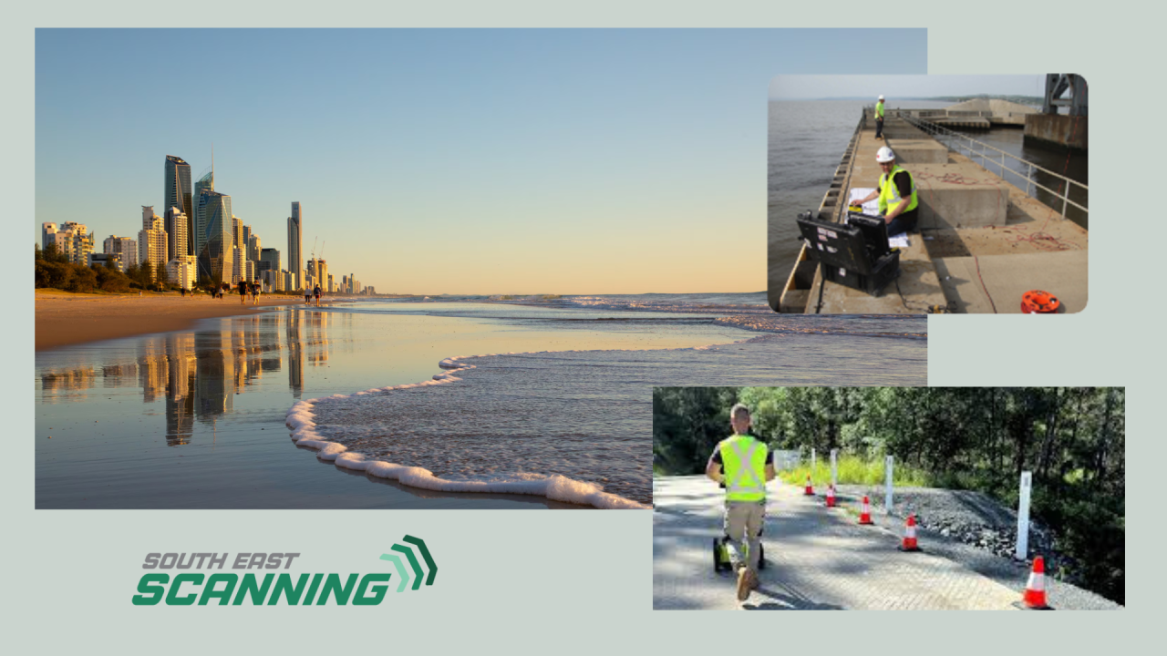
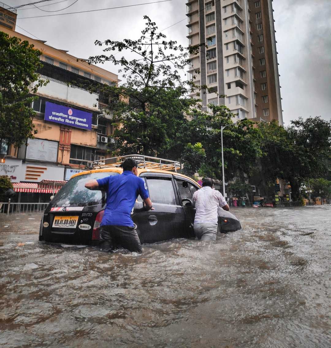
Natural disasters leave devastation in their wake, affecting homes, businesses, and infrastructure. In Australia, severe storms, flooding, and cyclones can cause significant damage, particularly in coastal regions like the Gold Coast and the Sunshine Coast. Rapid and effective recovery is critical when disaster strikes – not just for safety but for rebuilding communities and restoring essential services.
Ground-penetrating radar (GPR) is a potent post-disaster assessment and recovery tool. This non-destructive technology plays a vital role in evaluating structural integrity, locating underground utilities, and identifying hidden hazards – all without the need for invasive digging or demolition.
At South-East Scanning, we specialise in post-disaster scanning and damage assessments, ensuring recovery efforts proceed safely and efficiently after extreme weather events like Cyclone Alfred.
The Impact of Cyclone Alfred on the Gold Coast & Sunshine Coast
Cyclone Alfred was a severe tropical system that brought intense rainfall, flooding, and powerful winds to Queensland’s coastal regions. Events like this can cause:
🌊 Flooding and soil erosion – Weakening roads, bridges, and building foundations.
💧 Underground utility damage – Disrupting water, gas, and electrical lines.
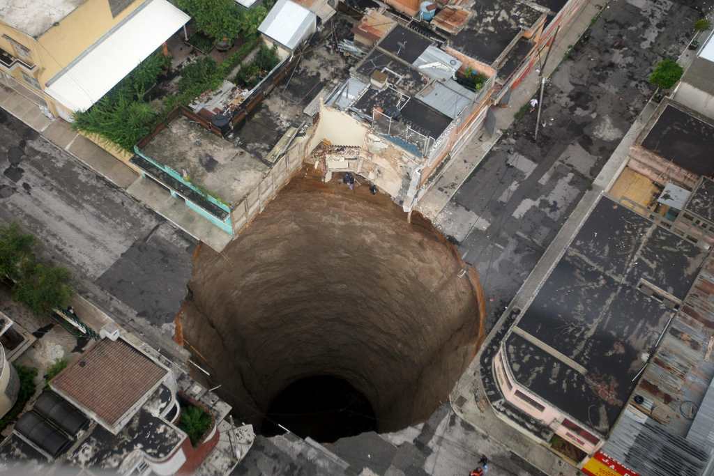
⚠ Hidden voids and sinkholes – Forming beneath driveways, pavements, and structures.
🏗 Structural instability – Caused by shifting foundations and compromised rebar in concrete.
GPR scanning is an essential tool for property owners, engineers, and local councils to assess damage and make informed decisions about repairs and rebuilding.
How GPR Scanning Aids in Natural Disaster Recovery
GPR provides fast, accurate, and non-invasive insights into post-disaster damage, helping to prevent costly mistakes and unsafe construction.
1. Detecting Underground Voids & Sinkholes
Flooding and strong winds can wash away soil, leaving dangerous voids beneath roads, driveways, and structures. These voids may not be visible from the surface, but they pose a serious risk of ground collapse if left unchecked.
✔ GPR can detect hidden subsurface voids before they cause sinkholes or structural failures.
✔ Helps councils assess road stability before reopening flood-damaged areas.
✔ Protects property owners by identifying unstable ground beneath homes and businesses.
2. Assessing Structural Integrity in Concrete & Buildings
Cyclones and floods can weaken concrete structures, bridges, and retaining walls. Over time, moisture infiltration can lead to corrosion of rebar and post-tension cables, causing long-term damage.
✔ GPR scanning identifies internal cracks, voids, and weakened reinforcement in concrete.
✔ Prevents premature rebuilding by ensuring structures are still sound.
✔ Helps engineers develop accurate repair plans without unnecessary demolition.
3. Mapping and Locating Utilities to Restore Services
After a natural disaster, underground utilities (water, gas, power, and telecommunications) may be damaged, misplaced, or buried under debris. Traditional methods of locating utilities, such as digging or exploratory drilling, can be dangerous and time-consuming.
✔ GPR can accurately map underground utilities without disturbing the area.
✔ Prevents accidental damage to critical services during recovery efforts.
✔ Ensures a faster, safer water, electricity, and communication line restoration.
4. Identifying Flood-Damaged Soil Conditions
Flooding changes the composition of the soil, making it difficult to determine if the ground is stable enough for rebuilding roads, houses, or commercial structures.
✔ GPR can detect soil saturation levels to assess whether an area needs additional reinforcement before reconstruction.
✔ Helps geotechnical engineers determine where drainage improvements are needed.
✔ Reduces the risk of future foundation failure due to unstable ground conditions.
Why South-East Scanning is Leading Post-Disaster Recovery in Queensland
At South-East Scanning, we understand the urgent need for fast, accurate assessments after a natural disaster. Our cutting-edge GPR technology allows us to provide detailed subsurface insights that help local councils, businesses, and homeowners recover quickly and safely.
We have worked extensively in flood-affected and cyclone-hit areas across Brisbane, the Gold Coast, and the Sunshine Coast, delivering real-time, actionable data that prevents costly mistakes and ensures long-term stability.
Our team offers:
✔ Emergency post-disaster scanning for homes, businesses, and infrastructure.
✔ Specialised void detection, concrete assessment, and utility locating services.
✔ Non-invasive solutions that protect heritage structures and modern developments alike.
Conclusion
In the aftermath of a natural disaster, every decision counts. Rushing into repairs without a clear understanding of what’s beneath the surface can lead to dangerous structural failures, utility disruptions, and wasted resources.
Ground-penetrating radar (GPR) provides the clarity needed for safe, efficient disaster recovery, helping communities rebuild stronger and more resiliently.
If you need expert post-disaster scanning services, contact South-East Scanning today. We’re here to help you assess damage, locate utilities, and ensure your property is safe for rebuilding.
🔍 Recover smarter. Rebuild stronger. Trust the experts in GPR scanning. 🚀