Ground Penetrating Radar (GPR) is making waves in the construction industry. But why is it capturing the attention of engineers and professionals alike? This blog will explore the science behind GPR scanning and why it's becoming a go-to solution for modern construction projects. From understanding its core principles to its numerous applications and future potential, you'll discover why GPR is not just a trend but a necessity.
GPR is a cutting-edge technology that has revolutionised the way we approach construction projects. It uses radar pulses to image the subsurface and is commonly used for detecting underground utilities, voids, and other hidden objects. Unlike traditional methods, GPR offers a non-invasive and quick approach to gather vital information.
For construction professionals, this means making informed decisions without the guesswork. Whether you’re planning a major infrastructure project or a small renovation, the ability to see beneath the surface can save time, money, and prevent potential mishaps.
Understanding Ground Penetrating Radar in Construction
GPR is a cutting-edge technology that has revolutionised the way we approach construction projects. It uses radar pulses to image the subsurface and is commonly used for detecting underground utilities, voids, and other hidden objects. Unlike traditional methods, GPR offers a non-invasive and quick approach to gather vital information.
For construction professionals, this means making informed decisions without the guesswork. Whether you’re planning a major infrastructure project or a small renovation, the ability to see beneath the surface can save time, money, and prevent potential mishaps.
The Evolution of GPR Technology
While GPR is relatively new to the construction industry, its roots can be traced back decades. Initially used for geological surveys, the technology has evolved, becoming more sophisticated and accessible. Today, it’s a staple in many engineering projects, ensuring safety and accuracy.
The shift towards GPR stems from the growing need for precision in construction. With urban areas becoming more crowded, the demand for reliable subsurface scanning is higher than ever. GPR provides the clarity needed to plan and execute projects with confidence.
Why Engineers Are Turning to GPR
Engineers and construction professionals have long relied on outdated methods for subsurface exploration. However, GPR offers a compelling alternative. Its ability to deliver detailed insights quickly and safely makes it an attractive option for busy professionals.
By incorporating GPR into their workflows, engineers can reduce project delays and cut costs. The technology’s precision ensures that every scan yields valuable data, helping teams stay on schedule and within budget.
The Science Behind GPR Scanning
At the heart of GPR is the fascinating interplay of electromagnetic waves. These waves penetrate the ground, reflecting off different materials to create a detailed image of what lies beneath.
Electromagnetic Waves Unveiled
Understanding GPR starts with electromagnetic waves. These waves travel at varying speeds depending on the material they encounter. By measuring the time it takes for waves to return to the surface, GPR devices can determine the depth and shape of buried objects.
This non-intrusive method allows engineers to map underground features accurately. Whether it’s identifying pipes, cables, or voids, GPR provides a comprehensive view, minimising the risk of costly excavation errors.

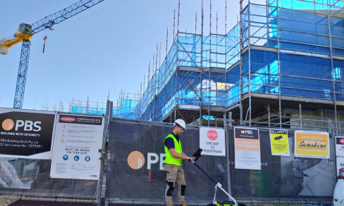
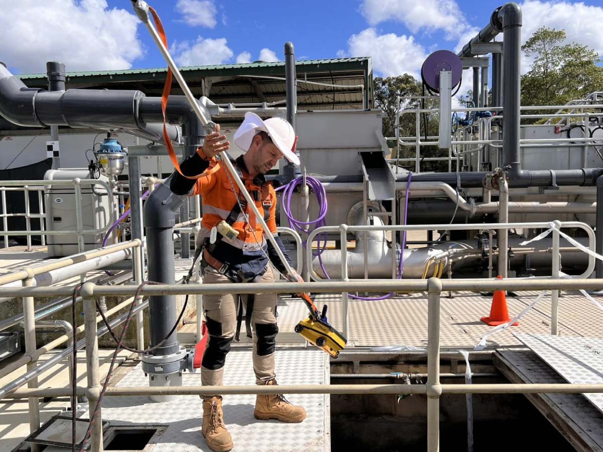
How GPR Devices Work
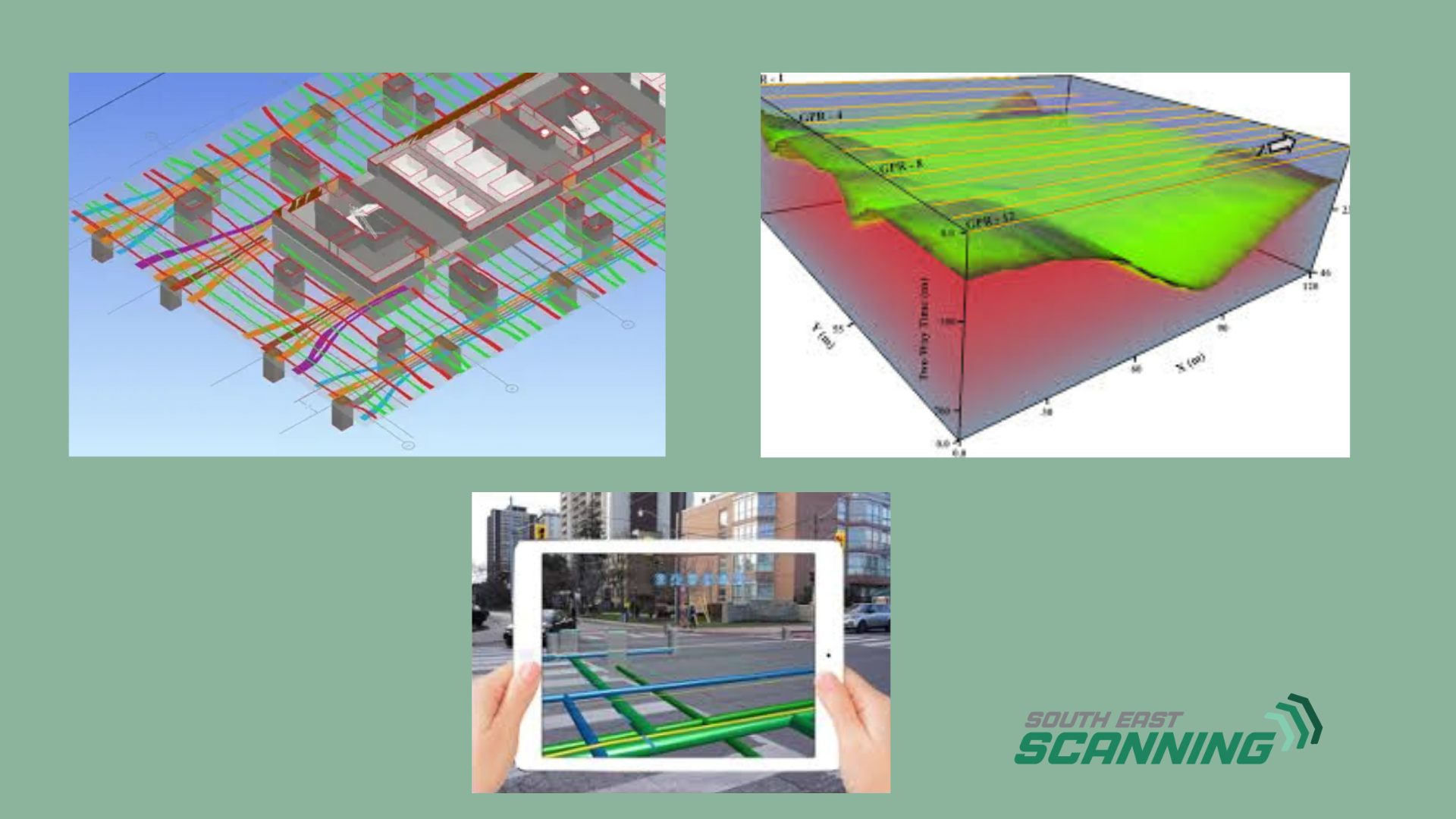
GPR devices consist of a transmitter and a receiver. The transmitter emits radar waves into the ground, while the receiver captures the returning signals. Advanced software then processes these signals to produce a visual map of the subsurface.
The versatility of GPR devices allows them to be used in various environments. From dense urban areas to remote sites, GPR is adaptable, delivering consistent results regardless of location.
Interpreting GPR Data
Interpreting GPR data requires skill and expertise. The resulting images, known as radargrams, reveal the subsurface’s secrets. Engineers must analyse these images carefully to identify anomalies and make informed decisions.
The ability to interpret GPR data accurately is crucial for successful project outcomes. It ensures that teams can confidently move forward with their plans, knowing they have a clear understanding of the site’s conditions.
Applications of GPR in Civil Engineering
GPR’s versatility makes it invaluable in civil engineering and construction. Its applications are vast, ranging from utility mapping to pavement analysis, each offering unique benefits.
Underground Utility Mapping
One of the most common uses of GPR is mapping underground utilities. Whether it’s water pipes, electrical cables, or gas lines, locating these utilities is essential to avoid damage during construction.
By providing precise location data, GPR helps teams avoid costly mistakes. It ensures that projects proceed smoothly, without the disruption of unexpected utility strikes.
Detecting Subsurface Void
Void detection is another critical application of GPR. Identifying voids early can prevent structural failures that compromise safety and integrity.
GPR’s ability to detect voids quickly allows engineers to address potential issues before they escalate. This proactive approach enhances safety and reduces the likelihood of costly repairs down the line.
Analysing Pavement Structures
GPR’s rise in popularity can be attributed to its numerous advantages over traditional methods. Its accuracy, speed, and safety benefits make it a preferred choice for many construction professionals.
Precision and Accuracy
GPR’s ability to deliver accurate results is unmatched. Traditional methods often rely on guesswork, whereas GPR provides clear, detailed images of the subsurface.
This precision ensures that projects are completed to the highest standards. Teams can trust the data they receive, reducing the potential for errors and rework.
Advantages of GPR Over Traditional Methods
GPR is also instrumental in pavement analysis. It helps engineers assess the condition of roads and identify areas requiring maintenance.
By scanning pavements, GPR provides data on layer thickness, moisture content, and other critical factors. This information is essential for developing effective maintenance plans that extend the lifespan of roadways.

Precision and Accuracy
GPR’s ability to deliver accurate results is unmatched. Traditional methods often rely on guesswork, whereas GPR provides clear, detailed images of the subsurface.
This precision ensures that projects are completed to the highest standards. Teams can trust the data they receive, reducing the potential for errors and rework.
Speed and Efficiency
Time is money in construction, and GPR offers a fast, efficient way to gather subsurface information. Scans can be conducted quickly, allowing projects to stay on track.
The efficiency of GPR reduces downtime and minimises disruption, ensuring that projects are delivered on time and within budget.
Enhanced Safety Measures
Safety is paramount in construction, and GPR enhances safety by reducing the need for invasive exploration. By providing reliable data, GPR minimises the risks associated with digging and excavation.
This focus on safety protects workers and the public, fostering a safer working environment for all involved.
Next Steps
GPR is reshaping the construction landscape, and its significance cannot be overstated. Its applications are vast, its benefits undeniable, and its potential limitless.
For those yet to explore GPR, now is the time to act. By adopting GPR, you can revolutionise your approach to construction, achieving new heights of efficiency and success.
Consider partnering with experts to integrate GPR into your projects. With the right guidance and support, you can unlock the full potential of this remarkable technology, paving the way for a brighter future in construction.
Ready to see Screening Eagle Inspect in action? Reach out to us and discover how intelligent inspection can elevate your next project!