Pool deck leak investigation using ground penetrating radar
Coolum Peregian Aquatic Centre, Coolum Beach, Sunshine CoastWhen the learn to swim pool at the Coolum Peregian Aquatic Centre developed a further leak in its return pipework, Sunshine Coast Council needed to understand what was happening beneath the tiled deck before the repair went ahead. We completed a ground penetrating radar (GPR) survey of the pool surround and issued a 20 page investigation report the following day.
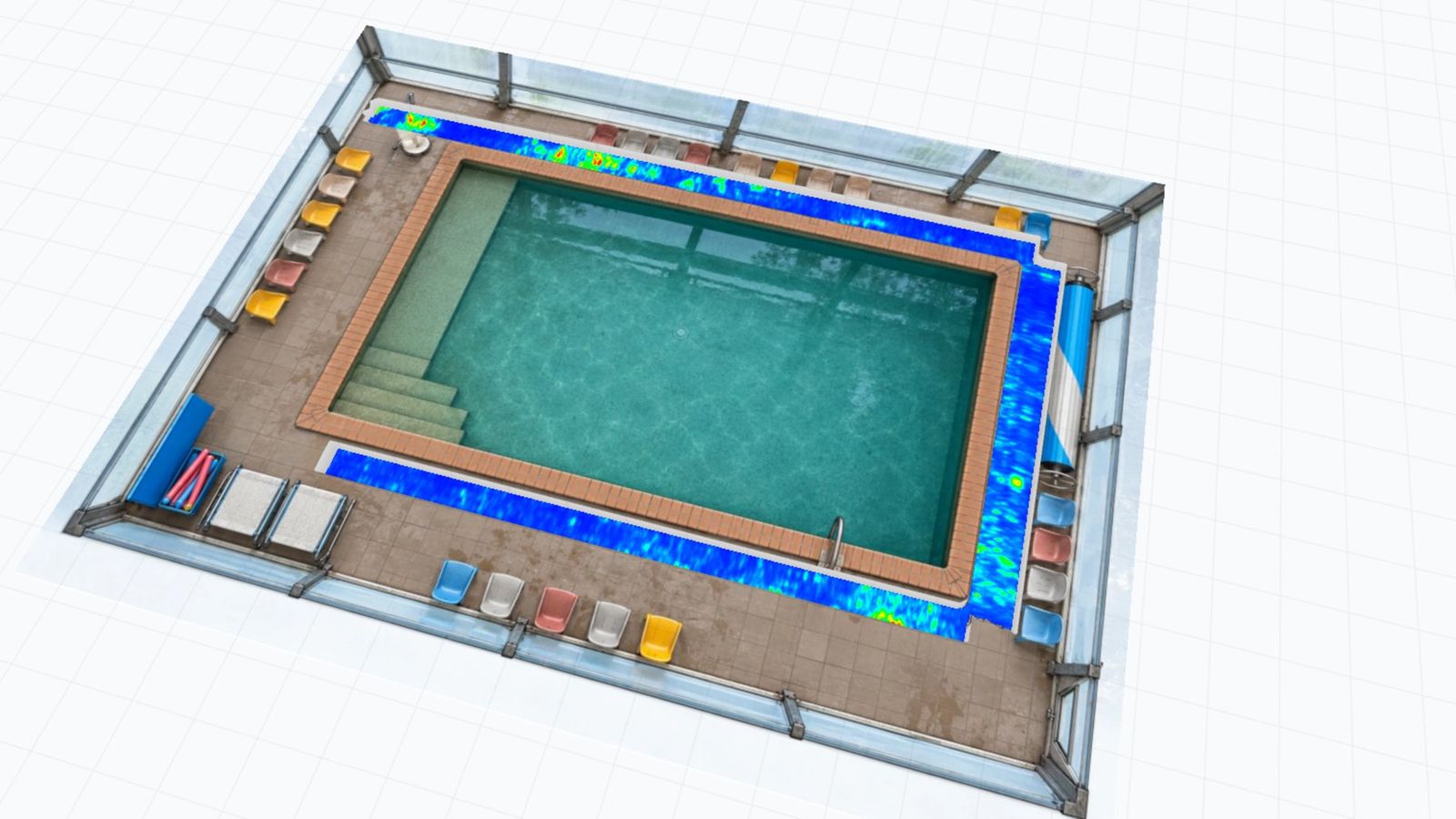
GPR amplitude slices beneath the deck reinforcement, shown on a 3D model of the pool enclosure. Red indicates the strongest reflections.
A return line that had leaked before, in the same spot
The pool return line had leaked before. A leak detection contractor located a crack in the return pipe and a suspect T fitting along one edge of the pool, in the same area as two earlier return line repairs. A pressure test with the return pipes plugged ruled out the suction pipe, the pool structure, and the hydrostatic valve.
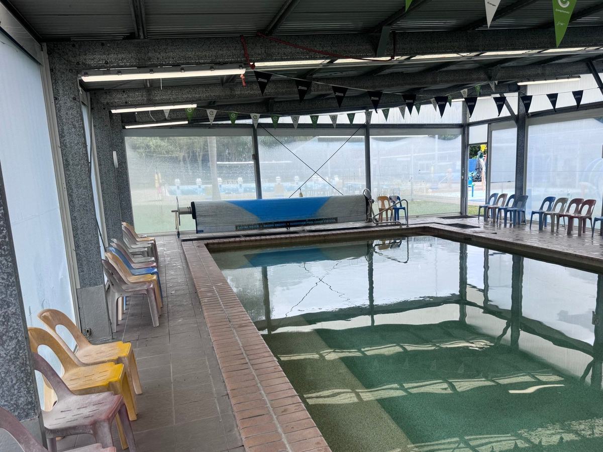
The learn to swim pool, viewed toward the pool cover roller. The narrow walkway at left was the main area of interest.
Repeat leaks in the same spot raise a harder question than where the pipe has failed. Has escaping water saturated or washed out the material that supports the deck, and how far does that condition extend?
Council wanted that answered before anyone lifted a tile, so the excavation could be set out properly and any wider risk to the deck and coping could be identified. The site brought its own constraints.
The pool sits inside a fully enclosed structure, so satellite positioning was not available.
The deck surface was wet across much of the surveyed area, and rubber matting lay along one edge.
The walkway along the leak edge is narrow and lined with seating, with a pool hoist and skimmer lid at one end.
The leak detection contractor had marked the leak location on the coping. That mark, and the locations of both earlier repairs, gave us fixed points to compare the radar data against.
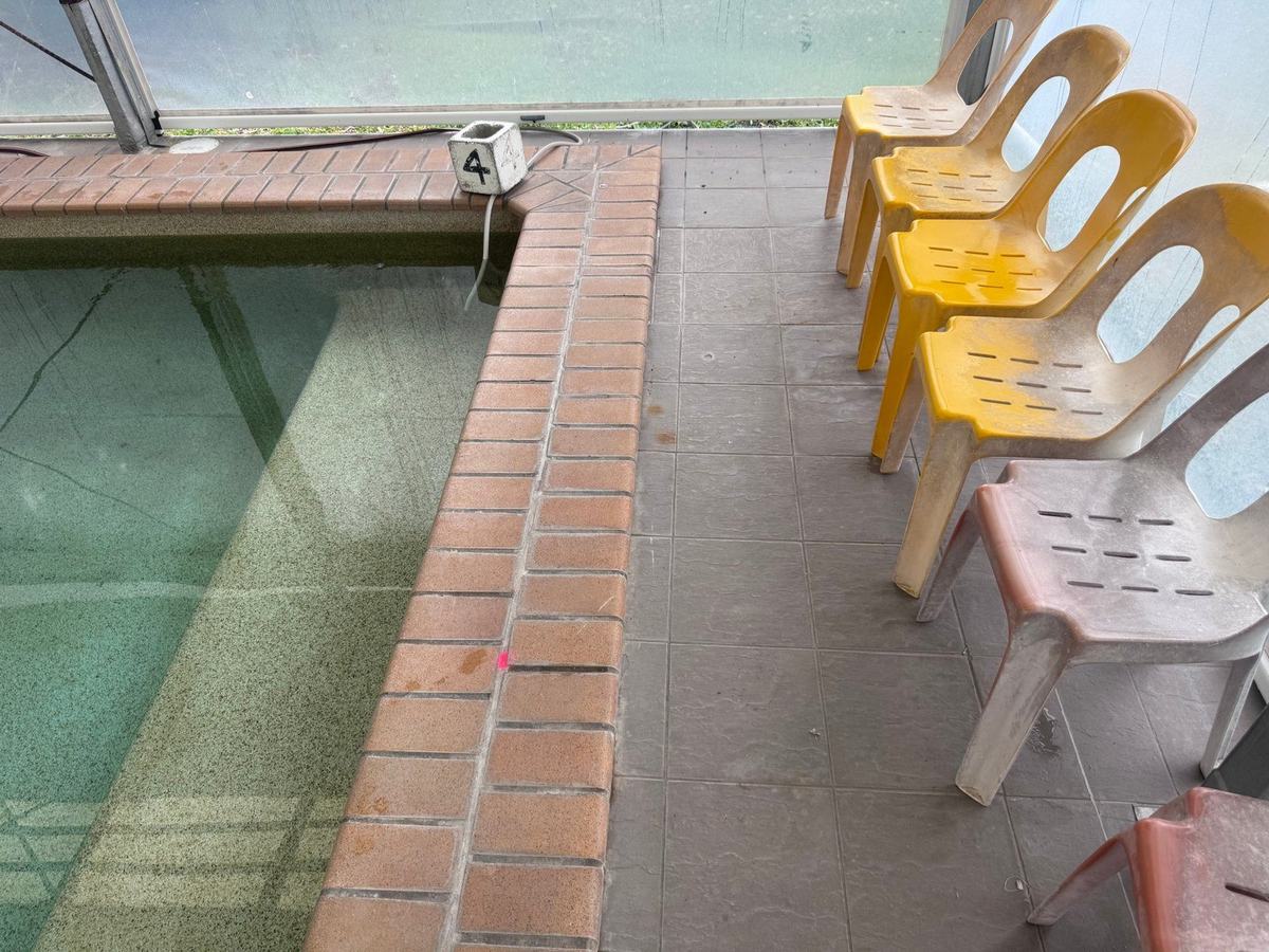
The leak location, marked on the coping by the leak detection contractor.
Three edges scanned from the tiles, with nothing lifted and the pool full
Our Senior Technician, Harley Murray, surveyed the tiled deck immediately beside the coping along three edges of the pool, using the IDS C-Thrue. Each edge was covered by a swath of parallel scan lines run along the deck, with the antenna in direct contact with the tiles. No tiles were lifted and the pool was not drained.
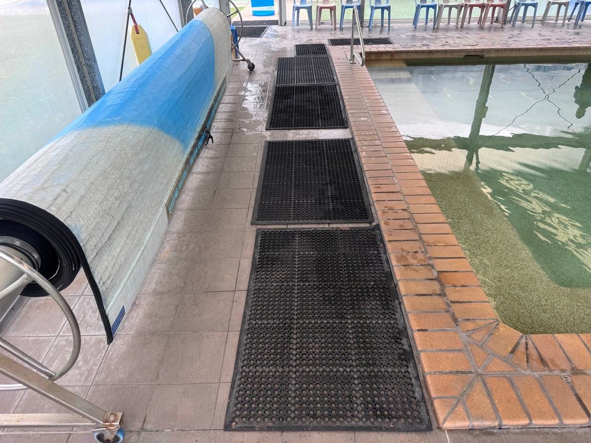
Wet tiles and rubber matting along one edge of the pool. Surface conditions like these are recorded in the report because they can affect antenna coupling.
A swath of parallel scan lines along each of the three surveyed edges, run on the finished tiled surface beside the coping.
Because the enclosure blocks satellite positioning, we referenced the data to a plan model of the pool enclosure built from site photographs. Every reading sits on a picture of the pool the client already recognises, so the findings can be read without any GPR training. The report is clear that the model is unsurveyed and that positions must be set out on site from physical references before any intrusive works.
Data processed in Geolitix as equally spaced traces at 100mm spacings, with a propagation velocity of 0.1 m/ns applied to convert travel time to depth. In-line slices at the depth of the deck reinforcement resolve the reinforcement layout and confirm the data are continuous across each swath. Cross slices beneath the reinforcement, at approximately 140mm to 235mm (+/- 20%), record changes in the material supporting the deck.
Each zone of elevated amplitude in the cross slices was checked against the vertical profiles (B-scans) beneath it, so that every finding in the report rests on two independent views of the same data.
Four zones stood out, and the largest sat right on the leak
Across most of the surveyed deck, the response beneath the reinforcement was low in amplitude and uniform. Laid out around the pool, four zones of elevated amplitude stand out against that background. The largest takes in the leak mark and both earlier repairs.
Along the leak edge, taking in the leak mark and the locations of both previous repairs.
Directly beneath the reinforcement, with a chaotic, ringing response below them.
One indicative of moisture ingress and/or loss of support, and three anomalies of unknown composition.
Schematic only. Positions are approximate and taken from the report, which references the data to an unsurveyed plan model of the enclosure. Positions must be set out on site from physical references before any intrusive works.
A disturbed zone beneath the deck, exactly where the pipe had failed
Across most of the surveyed area, the response beneath the reinforcement was low in amplitude and uniform. Against that background, four zones of elevated amplitude stood out (refer to Figure 1). A strong response where two swaths meet was identified as an edge effect and excluded from interpretation.
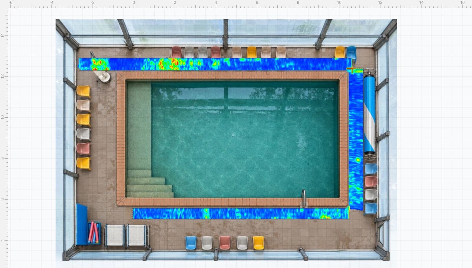
Figure 1. Cross slice beneath the reinforcement for all three swaths, shown on the plan model. Grid in metres.
The main zone, along the leak edge
The largest and most intense zone extended for approximately 2.9m along the edge where the leak had been located. In the B-scans, it appeared as a cluster of stacked, high-amplitude reflections at approximately 225mm (+/- 20%), directly beneath the reinforcement, with a chaotic, ringing response below them. The leak mark on the coping and the locations of both previous repairs fall within this zone.
That pattern is indicative, by observation, of an irregular, disturbed zone rather than a single discrete object, and of moisture ingress and/or loss of support beneath the deck.
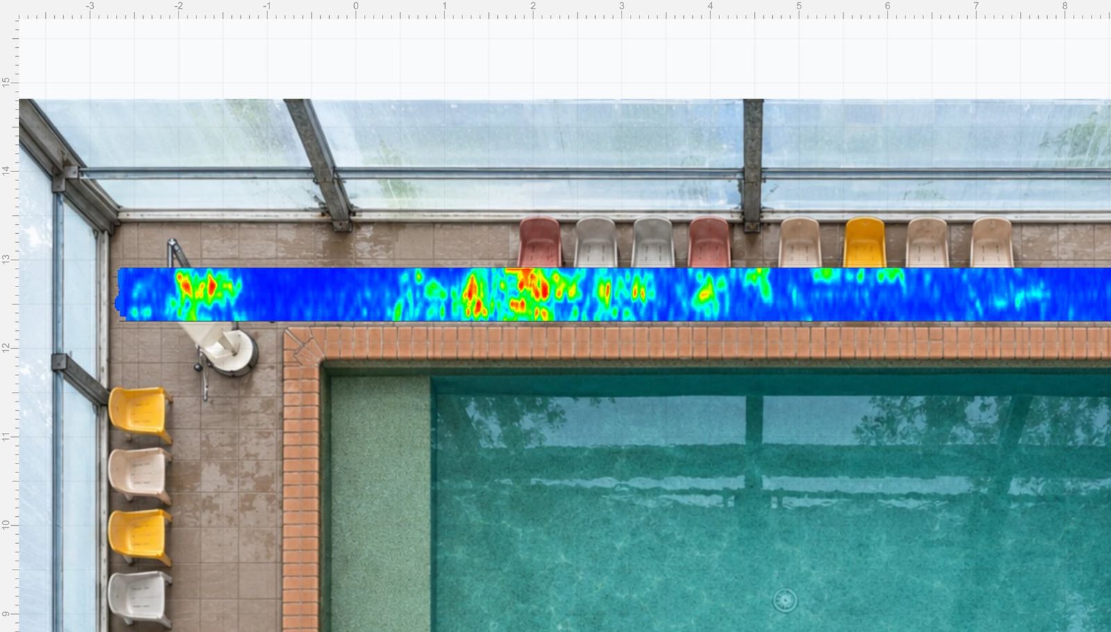
Figure 2. Cross slice along the leak edge. The main zone sits at centre, with a smaller zone beside the pool hoist at left.
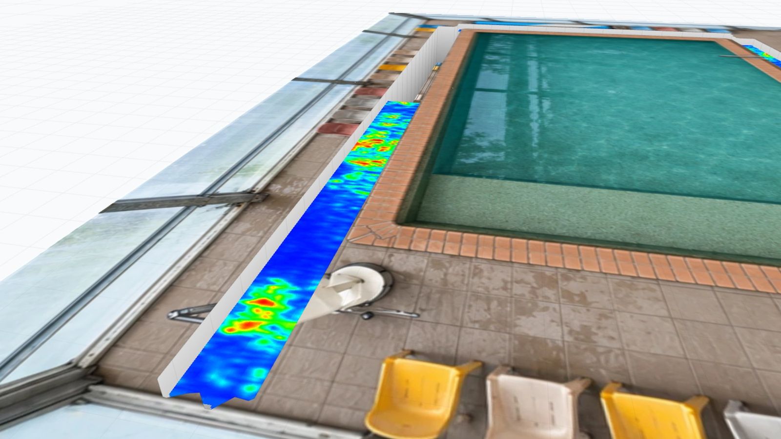
Figure 3. Oblique 3D view of the same edge, looking along the walkway past the pool hoist.
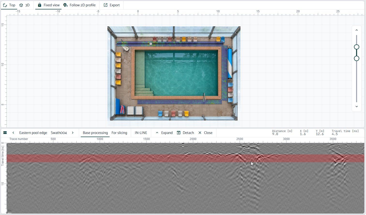
Figure 4. B-scan through the main zone. The shaded band marks the cross slice window, with stacked reflections and a disturbed response beneath it.
Three smaller zones, reported without a guess
Three smaller zones were also recorded: one beside the pool hoist base and skimmer lid, a discrete reflector at approximately 210mm (+/- 20%) toward one end of the opposite edge, and an isolated reflector along the third edge. None of these coincides with a reported leak location, and each is reported as an anomaly of unknown composition, with suggested lines of enquiry rather than a guess.
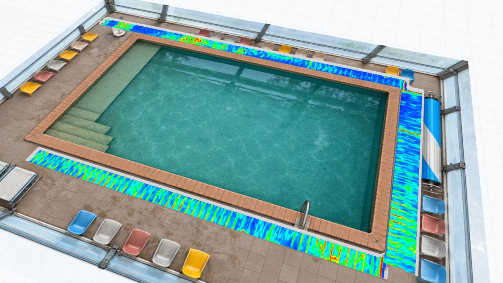
Figure 5. In-line slice at reinforcement depth, resolving the reinforcement as regular linear responses and confirming the data are continuous across the swaths.
Main zone. Indicative, by observation, of moisture ingress and/or loss of support beneath the deck.
Smaller zones. Each reported as an anomaly of unknown composition.
The strong response where two swaths meet, identified as an edge effect.
Reporting with clear limits
GPR records contrasts in the electromagnetic properties of materials. On its own, it cannot tell an air-filled void from saturated ground, disturbed backfill from earlier repairs, or embedded pipework, and it does not measure settlement or level change. At this site, the main zone also contained two previous repairs, and reinstated concrete, backfill, and fittings all contribute to the radar response.
Our report says so plainly. It offers one possible mechanism for a geotechnical engineer to consider, separates our observations from those of the leak detection contractor, and leaves cause and engineering conclusions to the appropriate engineers. That is what makes the findings safe to act on: the client knows exactly what the data show and what still needs to be confirmed.
- The extent of the main zone along the leak edge, taking in the leak mark and both previous repairs
- The location of three smaller zones, none of them at a reported leak location
- The reinforcement layout, and continuous data across every swath
- A baseline record of the deck condition on the inspection date
- How much of the main zone is saturation, loss of support, or disturbance from earlier repairs
- The composition of the three smaller zones
- Any settlement or level change, which GPR does not measure
- Cause and engineering significance, which sit with the geotechnical and structural engineers
A report, four drawings and a clear set of next steps
- A 20 page investigation report, with an executive summary, methodology and limitations, site and visual observations, the GPR findings, and a discussion of the observed mechanism.
- Four annotated drawings covering the cross and in-line slices in plan and 3D (refer to Figure 6).
- B-scans for the key zones, with the exact position and travel time of each reading.
- Access to the interactive dataset, retained as a baseline record of the deck condition on the inspection date.
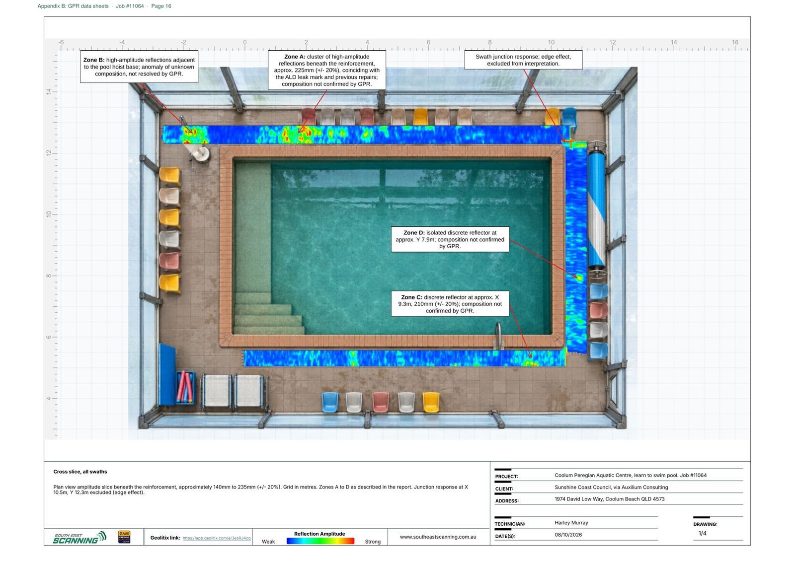
Figure 6. One of the four annotated drawings supplied with the report.
Recommendations
The report closed with staged recommendations, so the next steps were clear to everyone involved.
Proceed with the return line repair, set the excavation out to the full extent of the main zone plus its weaker continuation, and record the bedding and subgrade conditions during the excavation. The repair itself becomes the confirmation step.
Engage a geotechnical engineer to assess the subgrade, and a structural engineer to assess the coping and deck where loss of support is confirmed. Review as-constructed records for the pool hoist and skimmer, and commission a level survey if movement needs to be quantified.
Repeat the GPR survey over the same swaths after reinstatement, and compare it against the baseline.
The zones identified should be confirmed by intrusive investigation. GPR provides evidence about subsurface conditions; it does not provide engineering certification or geotechnical advice.
A defined excavation footprint instead of an open-ended dig
Instead of an open-ended dig, Council received a defined excavation footprint, a clear list of anomalous zones, and a plan for confirming each one. The investigation took a single site visit, required no tiles to be lifted, and was reported the following day. The baseline dataset also gives Council a straightforward way to check the repair once the deck has been reinstated.
One site visit, no tiles lifted, and a full report the following day.
Why use GPR for pool leak and void investigations?
Leaking pool pipework rarely announces how much damage it has done. Water can saturate bedding and carry fines away long before cracking or settlement shows on the surface. A GPR survey gives you a picture of the ground beneath the deck before you commit to excavation.
The same approach applies to pool concourses, plant rooms, slab on ground, hardstands, and other areas where water may have affected the material beneath a slab. Find out more about our concrete scanning, structural investigation and analysis, and GPR scanning on the Sunshine Coast.
GPR for pool decks and slabs
Can GPR detect voids under a pool deck?
GPR detects changes in the material beneath the deck, such as voiding, saturation, or disturbed backfill, as zones of elevated reflection amplitude. It cannot identify the composition of a reflector on its own, so the zones it identifies should be confirmed by intrusive investigation.
Do the tiles need to be lifted, or the pool drained?
No. The antenna runs directly over the tiled deck, and the survey does not require the pool to be drained.
Can GPR be used inside an enclosed pool hall?
Yes. Where satellite positioning is unavailable, we reference the data to a plan model of the space, so every finding can be located against features you can see on site.
How quickly can we have a report?
On this project, the full report was issued the day after site attendance. Turnaround depends on the size and complexity of the investigation, and we confirm it when we quote.
Does a GPR survey replace a geotechnical or structural engineer?
No. GPR provides evidence about subsurface conditions; it does not provide engineering certification or geotechnical advice. Our reports recommend assessment by a geotechnical and/or structural engineer wherever loss of support, movement, or subgrade concerns are involved.
Talk to us about your project
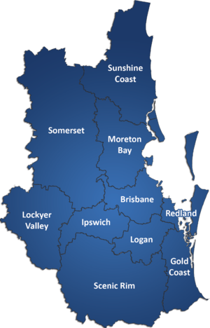
We can undertake GPR investigations of pool decks, slabs, hardstands, and other concrete structures across the Sunshine Coast, Brisbane, and the Gold Coast. For a quote or to discuss a site, call 1300 175 543 or email info@southeastscanning.com.au.