
Ground
Penetrating
Radar
Locate utilities, rebar, voids, and buried hazards with precision — before you cut, drill, or dig. Professional GPR scanning across South East Queensland.
The Technology
What Is Ground
Penetrating Radar?
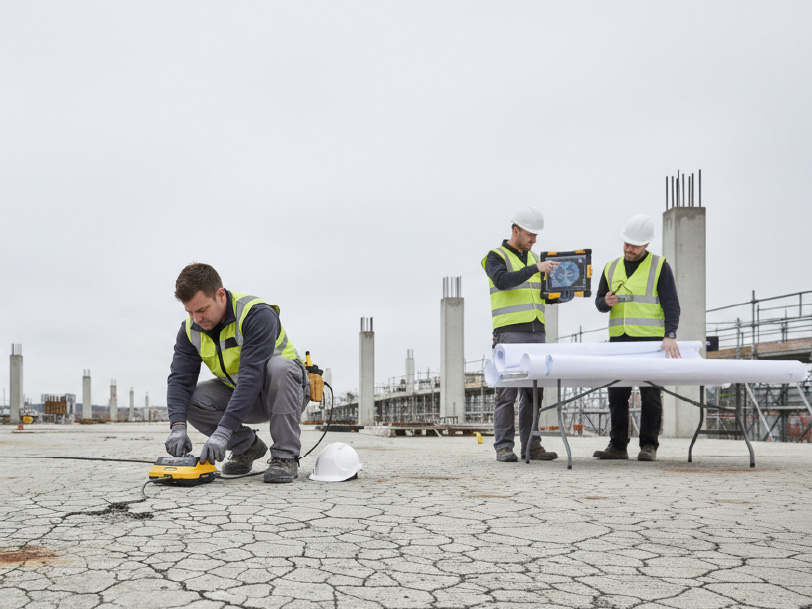
Ground Penetrating Radar (GPR) is a non-destructive geophysical method that uses high-frequency radio waves to image what lies beneath a surface — concrete, soil, asphalt, or rock — without excavation, drilling, or surface damage.
A GPR antenna transmits pulses of electromagnetic energy into the material being surveyed. When those pulses hit a boundary between materials with differing electrical properties — a rebar bar in concrete, a plastic pipe buried in soil, an air-filled void beneath a slab — some energy reflects back to a receiver. By measuring the time and strength of those reflections, GPR software generates a cross-sectional profile of the subsurface in real time.
The result is a detailed image showing depth, position, and relative density of buried objects — without touching a drill or excavator. It is one of the fastest, safest, and most cost-effective investigation tools available to construction, civil, and infrastructure industries.
Key GPR Facts
The Process
How Ground Penetrating Radar Works
From the moment the antenna touches the surface to the final marked-up report — fast, precise, and entirely non-invasive.
Signal Transmission
The GPR antenna emits short bursts of electromagnetic energy — typically 250 MHz to 2.6 GHz — into the surveyed material. Higher frequencies deliver sharper images at shallow depth; lower frequencies penetrate deeper.
Reflection & Return
When the signal crosses a boundary between materials with differing dielectric properties — steel rebar in concrete, a pipe in soil — a portion reflects back toward the surface while the rest continues downward.
Signal Capture
A receiving antenna captures the returning echoes. The elapsed time between transmission and reception, combined with known wave speed through the material, gives depth with high accuracy.
Data Processing
Specialist software processes thousands of individual waveforms (A-scans) to compose a 2D cross-section (B-scan/radargram) and, when required, 3D depth slices. Hyperbolic reflections identify point targets such as pipes and rebar.
Expert Interpretation
Our experienced technicians interpret radargram imagery in real time on site, identifying targets by shape, amplitude, and depth. Findings are physically marked on the surface for immediate use by your team.
Detailed Reporting
A comprehensive report including annotated site plans, radargram images, and depth tables is delivered following the survey — formatted for engineers, builders, and project managers.
Your Project
What to Expect, From Quote to Report
A straightforward process designed to fit around your project timeline, not the other way around.
Enquiry & Free Quote
Tell us the location, surface type, and what you need located. We'll provide a fixed-price quote, usually within the same business day.
Booking & Confirmation
We schedule a time that suits your project, with same-day or next-day mobilisation available across South East Queensland.
On-Site Scanning
Our technician surveys the area and marks findings directly on the surface in real time — your crew can get to work straight away.
Report Delivery
A detailed written report — annotated plans, radargram imagery and depth data — is emailed to you, typically within 24–48 hours.
Use Cases
GPR Scanning Applications
Ground Penetrating Radar is a versatile technology used across construction, infrastructure, engineering, and environmental disciplines.
Concrete Scanning & Rebar Location
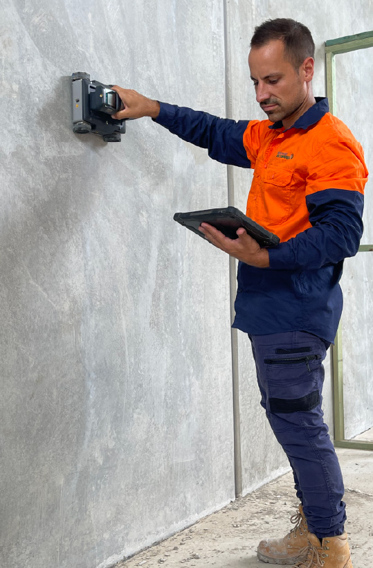
Locate reinforcing steel, post-tension cables, conduits, and embedded objects in slabs and walls before cutting, coring, or drilling — preventing costly structural damage.
Utility & Service Location
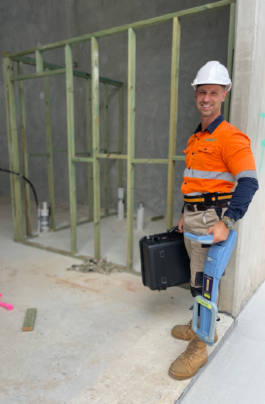
Map buried pipes, cables, conduits, and ducts in soil or under asphalt. GPR detects metallic and non-metallic utilities — something traditional cable locators cannot do alone.
Void & Subsidence Detection
Identify air-filled voids, sinkholes, and subsidence zones beneath slabs, roads, and embankments before they become structural failures or safety hazards.
Road & Pavement Assessment
Evaluate pavement layer thickness, sub-base condition, and detect delamination or moisture infiltration across roads, car parks, and runways without core sampling.
Structural Investigation
Assess the internal condition of bridges, retaining walls, car park decks, and columns — identifying corrosion, cracking, and layer separation before it surfaces.
Cemetery & Grave Site Surveys
Locate unmarked burials, identify grave boundaries, and produce accurate cemetery plans for heritage, development, and repatriation projects without disturbing remains.
Slab & Foundation Inspection
Inspect residential and commercial slabs for moisture ingress, voids beneath the slab, post-tension cable condition, and reinforcement depth prior to renovations.
Geotechnical Investigation
Characterise soil stratigraphy, bedrock depth, and buried geological features to support foundation design, retaining wall construction, and site development planning.
Electrical Fault & Asset Location
Trace underground electrical cables, locate faults, and verify asset depth and routing prior to earthworks — reducing the risk of cable strikes and unexpected outages.
Why GPR?
GPR vs Alternative Methods
Not all subsurface investigation methods deliver the same results. Here is how Ground Penetrating Radar compares.
Ground Penetrating Radar
Cable Locators / EMI
GPR Advantages Over X-Ray
Concrete X-Ray Limitations
Note: GPR and Concrete X-Ray are complementary tools. Where maximum resolution is needed on a specific small area of concrete, X-Ray may supplement GPR perfectly. South East Scanning offers both services. Learn more about Concrete X-Ray →
Equipment
GPR Equipment & Technology
The quality of a GPR survey depends on the equipment used and the operator's expertise. We use professional-grade systems with a full range of antenna frequencies.
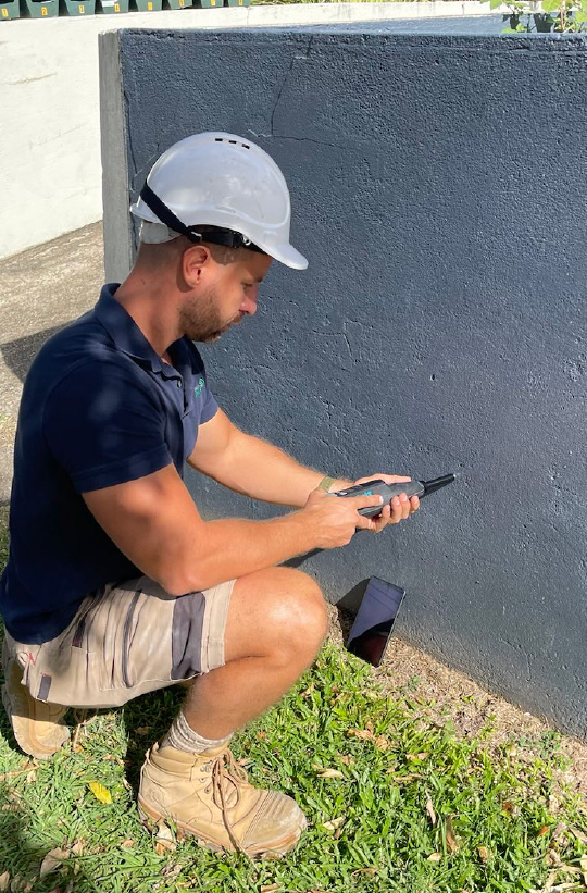
Antenna selection is critical: a 2.6 GHz antenna delivers very high resolution images ideal for shallow concrete scanning (locating rebar, conduit, post-tension cables), while a 250 MHz antenna penetrates several metres into the ground — suited to utility mapping and geotechnical profiling.
Our equipment supports 3D data acquisition — multiple parallel scan lines are processed to produce horizontal depth slices, allowing clients to view the subsurface layer by layer. This is particularly valuable for congested utility corridors, complex reinforcement layouts, and archaeological surveys.
Data is processed with specialist GPR software both in the field and post-survey, ensuring the most accurate possible interpretation before results are finalised and reported.
| Antenna Frequency Range | 250 MHz — 2.6 GHz |
| Max Depth in Concrete | Up to ~600 mm (varies with mix) |
| Max Depth in Soil | Up to 4–6 m (dry sandy conditions) |
| Minimum Feature Size | ~10 mm at high frequency |
| Scan Speed | Walking pace — rapid area coverage |
| Data Output | 2D radargrams, 3D depth slices |
| Radiation | None — radio waves only |
| Marking Method | Physical paint/chalk marking on site |
| Report Format | PDF, site plan overlays, DXF/CAD |
Actual depth and resolution depend on antenna selection, material properties, moisture content, and site conditions. Our technicians will advise on expected performance for your project prior to commencement.
Interactive Tool
See What GPR Actually Sees
Every antenna is a trade-off between how deep the signal reaches and how sharp the picture is. Choose a frequency below and watch five real jobsite targets appear — or vanish — beneath the surface, using the same trade-offs our technicians weigh before every scan.
- 1 Rebar Mesh75 mm deep —
- 2 Electrical Conduit220 mm deep —
- 3 Post-Tension Cable400 mm deep —
- 4 Stormwater Pipe1.4 m deep —
- 5 Sewer Main2.6 m deep —
Illustrative performance envelope based on typical site and material conditions. Actual depth and resolution vary with soil moisture, concrete density and reinforcement congestion — every quote includes an on-site assessment to confirm the right antenna for your job. *250 MHz depth range applies to dry, sandy soil; denser or wetter ground reduces penetration.
Transparent Pricing
What Affects the Cost of a GPR Scan
Every site is different, which is why we provide fixed, obligation-free quotes rather than a blanket per-metre rate. These are the main factors we weigh up:
Site Size & Area
Larger areas take longer to cover at the survey-grade line spacing needed for reliable detection.
Surface Type
Soil, concrete, and asphalt each require different antenna frequencies and survey approaches.
Depth & Complexity
Deeper targets, congested utility corridors, or heavily reinforced concrete need more careful interpretation.
Site Accessibility
Remote locations, restricted access, or out-of-hours work can affect mobilisation and survey time.
Urgency & Timeframe
Same-day or after-hours callouts to meet tight construction schedules may carry a priority rate.
Reporting Requirements
Standard marked-up plans versus full CAD/DXF deliverables and engineering-grade documentation.
What You'll Receive
More Than Marks on the Ground
Every survey is backed by documentation your engineers, builders, and project files can actually rely on.
- Annotated site or floor plan showing all located targets
- Radargram (scan) images for key transects
- Depth and material estimates for each target
- Photographic record of surface markings
- PDF report, with CAD/DXF overlays available on request
Who We Work With
Industries We Serve
GPR is for any sector where knowing what lies beneath before disturbing it is essential for safety, compliance, or cost control.
Construction & Civil Engineering
Before any coring, sawcutting, or ground-breaking, GPR is the first line of defence against striking hidden utilities, cutting structural rebar, or disturbing contaminated ground.
Government & Local Councils
Road pavement assessments, utility asset verification, stormwater and drainage mapping, and cemetery surveys for heritage and development planning across council-managed land.
Mining & Resources
Underground utility mapping at mine sites, structural inspection of concrete infrastructure, void detection in haul roads, and geotechnical profiling for pit wall assessment.
Hospitals & Healthcare
GPR is the preferred scanning method in hospital environments because it produces zero radiation, allowing scanning in occupied buildings without patient or staff relocation.
Utilities & Infrastructure Owners
Asset location, depth verification, and condition assessment for water authorities, gas distribution networks, telecommunications carriers, and electricity network operators.
Environmental & Archaeological
Contaminant plume mapping, buried drum location, archaeological feature identification, and forensic site investigation — all without disturbing what lies beneath.
South East Scanning
Why Choose Us?
We are South East Queensland's dedicated scanning specialists — not a general contractor with a scanner on the side. GPR is what we do, and we do it thoroughly.
Specialist Operators
Our technicians are trained specifically in GPR data acquisition and interpretation. Reading a radargram correctly requires real experience — we have it.
Fast Mobilisation
We cover South East Queensland and can often mobilise same-day or next-day to meet tight construction schedules and time-critical investigations.
Detailed Reporting
Every survey comes with a full written report including site plans, annotated radargrams, and depth data — not just painted marks on the floor.
Fully Insured
Public liability and professional indemnity insurance covers all our scanning activities — giving you and your clients complete confidence on every project.
Multi-Method Capability
Where GPR alone isn't enough, we also offer Concrete X-Ray, Thermal Scanning, UPV Testing, and Structural Investigation to complete the picture.
Local Knowledge
Based in South East Queensland, we understand the region's soil types, construction standards, and infrastructure challenges — knowledge that improves every scan.
Proof In The Field
Ground Penetrating Radar Case Studies
A look at real GPR projects we've delivered across South East Queensland and beyond — from aquatic centres and bridges to ports, cemeteries and large industrial sites.
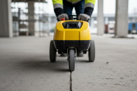
GPR and Structural Assessment of an Aquatic Centre
Used GPR and concrete scanning to assess three pool shells and a suspended slab at a regional aquatic centre, confirming sound construction and pinpointing a short watch-list — no demolition required.
Read Case Study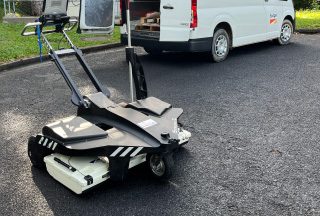
Cemetery Survey — TMR Therwine Street
Contracted by the Queensland Department of Transport and Main Roads to run a GPR survey along Therwine Street, locating unmarked graves ahead of planned works.
Read Case Study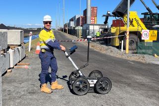
Void Detection Survey — Port of Brisbane
Engaged by Douglas Partners to run a targeted GPR survey across active port infrastructure, identifying subsurface voids before they became a safety issue.
Read Case Study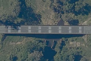
Hidden Asphalt Risks at Marion Creek Bridge
RoadTek Mackay chose a non-destructive GPR approach over traditional coring — and the results told a more complex story than anyone anticipated.
Read Case Study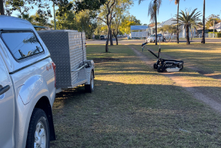
Large-Scale Subsurface Mapping — ARCOS Dalby
A large-scale GPR survey across an expansive industrial site for ARCOS, mapping subsurface conditions ahead of development.
Read Case Study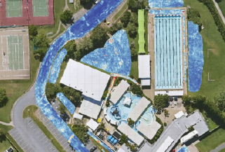
GPR Investigation of Gladstone Leisure Centre
A two-stage GPR investigation revealing structural performance, subsurface conditions, and the root cause of pool temperature irregularities.
Read Case StudyService Areas
GPR Scanning Locations Across South East Queensland
South East Scanning operates across the full SEQ corridor — from Gympie in the north to the Gold Coast in the south.
GPR Scanning
Brisbane
From CBD high-rises to suburban renovations, Brisbane's mix of dense infill construction and ageing underground infrastructure makes pre-works scanning essential. We cover the city and surrounding suburbs with rapid mobilisation for urgent jobs.
Scanning Conditions in Brisbane
Brisbane's older inner-city suburbs sit on a mix of reactive clay and rock, while the CBD and surrounding high-density precincts are built on heavily reinforced slabs, post-tensioned car park decks, and congested service corridors. That combination makes accurate, real-time interpretation critical — both for renovation work on character homes and for commercial fit-outs in multi-storey buildings.
We regularly work alongside builders, structural engineers, and trade contractors across the city, locating rebar and conduit before coring, and mapping buried services before trenching or landscaping work begins.
Suburbs We Cover
GPR Scanning
Gold Coast
One of the busiest construction markets in the state, with high-rise towers, canal estates, and rapidly growing northern corridors all underway at once. We support builders and engineers from Coomera to Coolangatta with fast, reliable subsurface scanning.
Scanning Conditions on the Gold Coast
The Gold Coast's coastal sand profiles drain well and generally support strong GPR signal penetration, making the region well suited to utility mapping, geotechnical work, and slab investigation alike. The challenge here is volume and pace — major residential towers, canal-front developments, and rapidly expanding northern suburbs around Coomera and Pimpama are all moving at once.
We work directly with builders and civil contractors to keep pre-works scanning from becoming a bottleneck, with fixed-price quotes turned around fast and technicians who understand the tight sequencing of high-rise and broadacre residential builds.
Suburbs We Cover
GPR Scanning
Sunshine Coast
A region defined by coastal residential growth and a busy renovation market, stretching from Caloundra in the south to Noosa in the north. We support homeowners, builders, and civil contractors with dependable subsurface investigation across the coast and hinterland.
Scanning Conditions on the Sunshine Coast
From beachside renovations in Mooloolaba to acreage developments in the hinterland, the Sunshine Coast presents a wide variety of ground and slab conditions. Sandy coastal soils are generally favourable for GPR signal penetration, while hinterland sites can introduce more variable clay content that our technicians account for when planning antenna selection.
With extensions, pool installations, and granny flat builds common across the region, pre-works concrete and utility scanning has become a standard part of the local building process — and one we're set up to turn around quickly.
Suburbs We Cover
GPR Scanning
Ipswich
One of South East Queensland's fastest-growing corridors, with major new estates pushing out through Springfield and Ripley Valley alongside an established CBD and industrial base. We provide the subsurface data civil and earthworks contractors need to keep large-scale projects moving.
Scanning Conditions in Ipswich
Ipswich's growth corridors are largely greenfield, which means utility and service mapping ahead of subdivision earthworks is a recurring requirement — particularly around staged developments where existing infrastructure and new works overlap. The established CBD and surrounding suburbs bring a different mix, with older commercial buildings and industrial sites that need concrete scanning before retrofit or refurbishment work.
We work with civil contractors and developers across Springfield, Ripley Valley, and the wider Ipswich LGA to keep utility location and geotechnical groundwork ahead of the construction schedule, not behind it.
Suburbs We Cover
GPR Scanning
Gympie
Supporting Gympie's local construction, civil infrastructure, and agricultural sectors with professional GPR scanning — covering the township and surrounding rural and semi-rural properties at the northern edge of our service area.
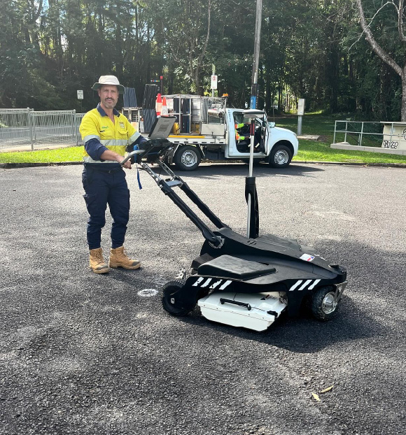
Scanning Conditions in Gympie
The Gympie region's mix of township infrastructure, rural acreage, and agricultural land calls for a different scanning approach to the dense suburban corridors further south. Utility and service mapping is often tied to farm infrastructure, irrigation lines, and older unrecorded services, while in-town projects follow the same concrete and civil scanning needs seen elsewhere in South East Queensland.
As this is at the edge of our regular service area, we schedule Gympie visits in advance — get in touch early to lock in a date that suits your project timeline.
Areas We Cover
We regularly travel to regional and rural areas beyond our listed locations across Queensland.
Contact Us About Your SiteClient Reviews
What Our Clients Say
Real feedback from clients across South East Queensland.
Gold Coast

Brisbane
Sunshine Coast
Ready to Scan?
Get a GPR Quote Today
Tell us your site location, what you need scanned, and we'll provide a fast, competitive quote and get you booked in.
Common Questions
Frequently Asked Questions
Everything you need to know before booking a Ground Penetrating Radar survey.
How accurate is Ground Penetrating Radar?
In favourable conditions — dry concrete, low-clay soils, targets with strong dielectric contrast — GPR can locate objects to within ±10–15 mm in depth and plan position. Accuracy is affected by material moisture content, antenna frequency, target type, and operator experience. Our technicians will advise on expected accuracy for your site conditions before commencing the survey.
Is GPR scanning safe to use in occupied buildings?
Yes. GPR uses low-power radio waves — not ionising radiation like X-rays or gamma rays. There is no health risk to operators, bystanders, or building occupants. Work can continue in adjacent areas while GPR scanning is conducted, which is a major advantage over Concrete X-Ray in occupied or live environments.
What can GPR not detect?
GPR has limitations in highly conductive materials such as wet clay soils, salt-contaminated ground, and heavily reinforced concrete where the rebar mat creates signal interference. Very thin features, closely spaced objects, and targets at greater depths in difficult ground conditions may be difficult to resolve. We will always provide an honest pre-survey assessment of what GPR can and cannot tell you about your specific site.
How long does a GPR scan take?
Scan time depends on the area to be covered, the complexity of the target environment, and the level of reporting required. A single concrete slab core location typically takes 30–60 minutes on site. Larger utility surveys or structural investigations may take a full day or more. We provide time estimates at the quoting stage.
Can GPR detect all types of pipes and cables?
GPR detects subsurface features by the contrast in dielectric properties between the target and surrounding material — not by whether the target is metallic. This means it can find plastic (PVC, HDPE), ceramic, concrete, and other non-metallic pipes and conduits that cable locators miss entirely. Combining GPR with an electromagnetic locator provides the best coverage for utility surveys.
What is the difference between GPR and Dial Before You Dig?
Dial Before You Dig (DBYD) is a notification and information service that provides utility location records submitted by asset owners — it tells you what utilities are known and registered in the area. GPR is a physical on-site survey that finds what is actually in the ground, registered or not. Many utilities are unregistered, poorly recorded, or located differently than plans indicate. GPR is the ground truth that validates and supplements DBYD information.
Does GPR work through asphalt?
Yes. GPR routinely surveys through asphalt pavement to locate buried services, assess sub-base layers, and map pavement thickness. Asphalt is generally a good medium for GPR signal propagation, particularly when dry. It is widely used for road and car park assessments across South East Queensland.
Do I need to prepare the surface before GPR scanning?
Generally, no major preparation is needed. The scanning surface should be accessible and reasonably flat. For concrete scanning, removing loose debris from the slab surface is helpful. For soil surveys, very long grass or heavy surface vegetation may need to be cleared. We will advise on any site preparation as part of our pre-survey consultation.
Quick Q&A
Not Sure Which Service You Need?
Tell us what you're trying to achieve and we'll point you to the right scanning method — whether that's GPR or one of our related services.
Ground Penetrating Radar
GPR is the right call for outdoor digging, trenching and excavation work. It detects metallic and non-metallic pipes, conduits and cables that electromagnetic locators miss entirely — giving you ground truth before you break soil.
Concrete Scanning
For coring, cutting or drilling into slabs and walls, Concrete Scanning is purpose-built to locate rebar, conduit and post-tension cables before you break through — protecting structural integrity and live services.
Concrete X-Ray
When concrete is heavily reinforced or the consequences of a strike are severe, Concrete X-Ray delivers higher-resolution imaging than standard scanning — resolving closely spaced rebar and complex post-tension layouts with greater clarity.
Geotechnical Surveying
Before footings, slabs or earthworks begin, Geotechnical Surveying profiles soil composition, bearing capacity and site characteristics — the groundwork data engineers and builders rely on to design safely.
Thermal Scanning
For moisture intrusion, hidden leaks or insulation gaps, infrared Thermal Scanning reveals temperature differentials invisible to the eye — pinpointing problem areas without opening up walls or roofing.
Related Services
Other Scanning & Investigation Services
When a project needs more than one method, we have the capability in-house to deliver the complete picture.