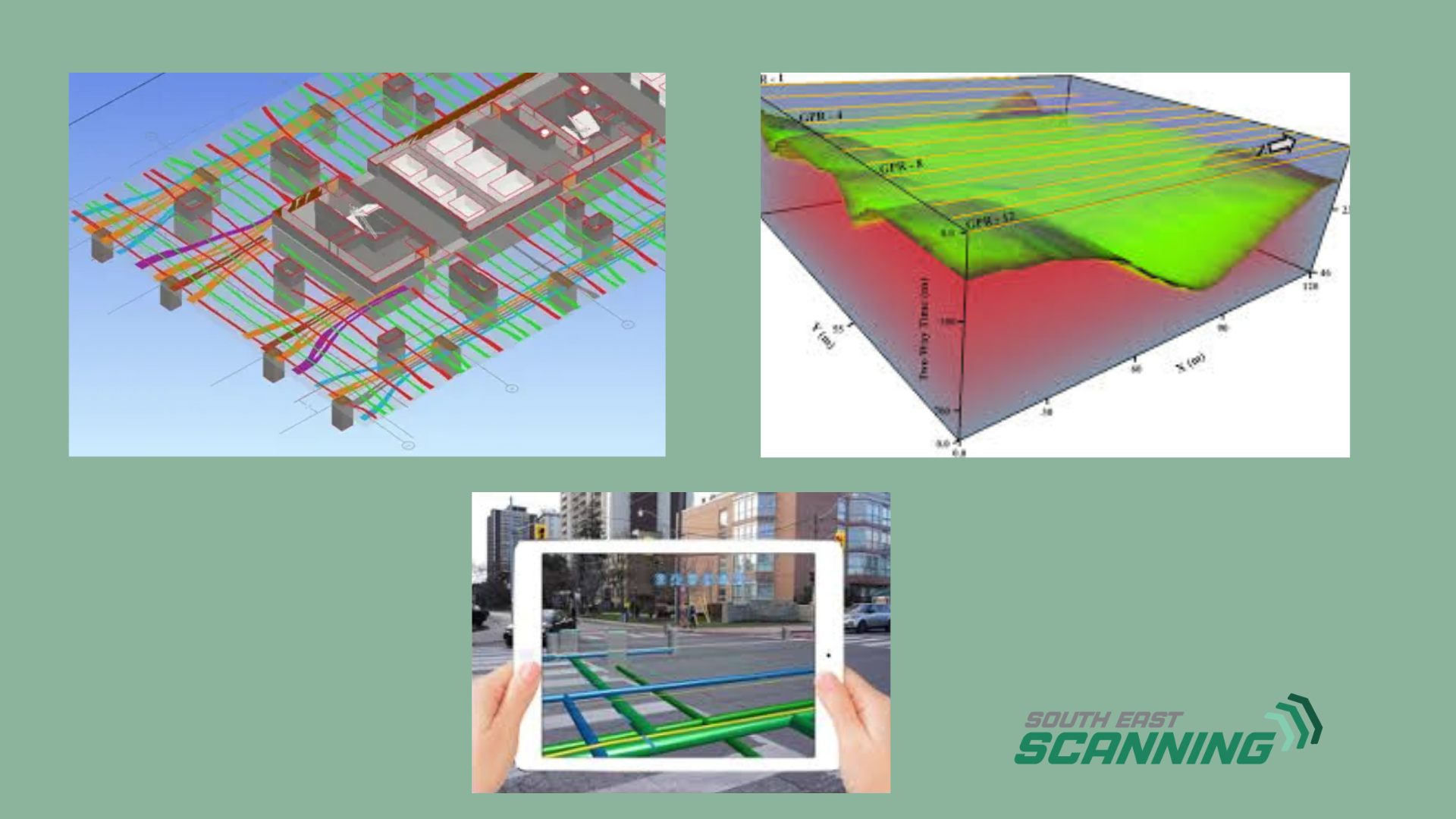
Ground-penetrating radar (GPR) technology has come a long way from grainy radargrams and interpretive guesswork. Today, we're entering a new era where GPR data is being transformed into immersive, interactive 3D models, thanks to rapid advancements in software, cloud processing, and augmented reality (AR) tools. The result? A more accurate, intuitive, and game-changing way to visualise and interact with what's hidden beneath our feet. At South-East Scanning, we're closely watching (and embracing) these innovations. The ability to take subsurface data and project it into a 3D digital environment is revolutionising how engineers, surveyors, builders, and asset managers approach underground infrastructure. And it's not science fiction - it's already here.
What is 3D Subsurface Mapping?
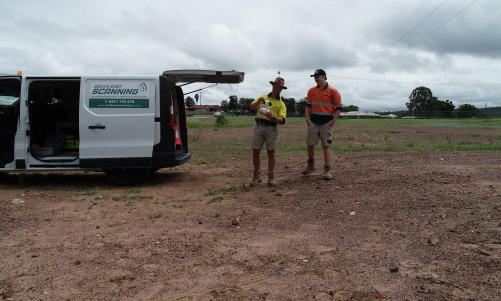
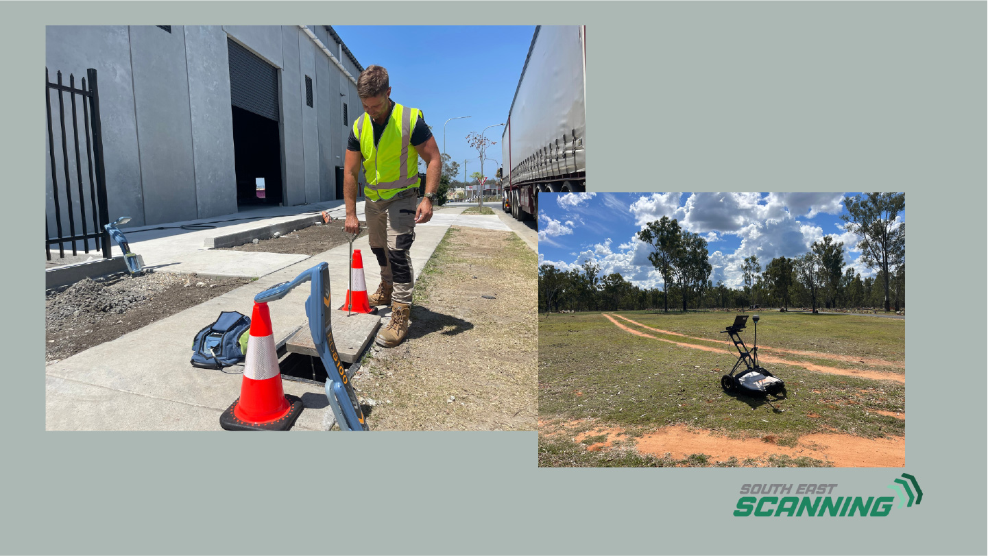
To undertake this investigation, we used the **Mala GX160MHz GPR system**, a powerful low-frequency radar ideal for penetrating thick concrete and identifying large-scale subsurface anomalies. The survey was coordinated with an **Emlid Reach RS2 RTK-GNSS system**, allowing all scan data to be spatially referenced and accurately mapped for 3D interpretation. This configuration enabled us to capture deep reflections across the full width of the structure — from abutment to abutment — while working under difficult conditions near the spillway edge.
The site posed a number of challenges, including uneven terrain, active water flow, and inaccessible upstream and downstream faces. However, our equipment was deployed with precision and stability, enabling continuous data acquisition across all accessible surfaces. The scanning grid covered the entire width of the weir crest with transects spaced approximately 600 mm apart.
Where Does Augmented Reality (AR) Come In?
The magic begins when this 3D data is integrated with AR platforms, allowing users to project subsurface maps onto the real-world environment using smartphones, tablets, or AR headsets. Imagine walking onto a construction site, holding up your phone, and seeing the exact position of stormwater drains, electrical conduits, or post-tension cables beneath the surface before a single tool is lifted.
- This isn't just cool tech - it's a massive leap in safety, planning, and collaboration. Teams can:
- Mark out utility positions more accurately in the field
- Detect conflicts with design or construction plans
- Reduce accidental utility strikes and delays
- Present data more clearly to stakeholders and clients
These tools make a meaningful difference in high-risk areas like the Brisbane CBD or tight job sites along the Gold Coast. GPR data becomes a shared visual reference, not just a technical report.
Real-Time Feedback and Cloud Processing
Modern GPR software collects better data and processes and visualises it faster. Some systems now allow real-time or near-real-time 3D visualisation on-site, with cloud syncing to project teams and stakeholders.
- This means that the moment a scan is completed, the data is available to:
- View in 3D from multiple angles
- Overlay with architectural models or excavation plans
- Share with engineers and decision-makers across the state or country
That speed is invaluable for fast-paced projects in Sunshine Coast developments or major infrastructure upgrades.
Training, Interpretation, and Confidence
One of the most significant challenges in GPR has always been interpretation. 3D mapping and AR help flatten the learning curve, offering more intuitive visual outputs that reduce subjectivity and error. Instead of relying solely on a technician’s annotated radargram, stakeholders can see the subsurface layout as a 3D model or interact with it in the field.
This improves training, helps build client confidence, and elevates the role of GPR scanning from a niche speciality to a core part of modern construction and engineering workflows.
How South-East Scanning is Getting Ready
At South-East Scanning, we’re already working with industry-leading GPR systems and exploring software partnerships that integrate with AR and 3D modelling platforms. As demand increases for innovative, accurate, and accessible underground mapping, we’re positioned to lead the charge in Queensland and beyond.
GPR should be more than a post-scan report. It should be an interactive digital layer of every job site, helping teams plan safer, build smarter, and collaborate better.
Final Thoughts
The future of GPR is not just about detecting what’s underground – it’s about making that information clear, usable, and available to everyone who needs it. With 3D subsurface mapping and AR, we’re entering a new phase of visibility, transparency, and technological integration in the built environment.
If you’re planning a project and want to see beneath the surface in a new way – we’re ready when you are. Get Your Fast, Free Quote Today!
#GPRTechnology #3DMapping #AugmentedRealityScanning