Finding loss of support beneath a live flyover, overnight
A state road authority suspected voiding beneath the relieving slabs of a Brisbane flyover. We scanned the full carriageway in a single night shift and gave the engineering team a georeferenced picture of where to look next.
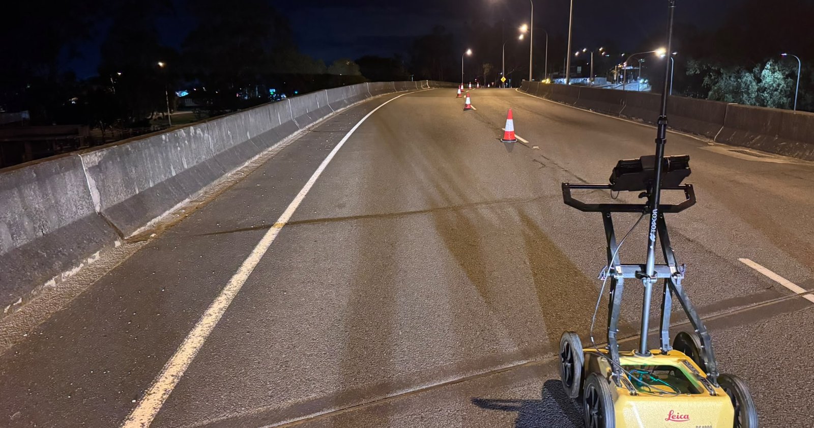
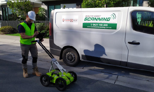
The Leica DS4000 dual-frequency GPR with GNSS positioning, working under lane closure on the night of the survey.
A slab built to hide settlement, and a suspicion it was losing support
Relieving slabs sit beneath the pavement where an embankment meets a bridge structure. They span the transition so that settlement of the fill does not show up as a bump at the joint.
When fill washes out or settles beneath a relieving slab, the slab loses support, and the first signs at the surface are usually subtle.
The client called late on a Thursday night. The road could only be closed at night, and their engineers needed answers to three questions.
At the relieving slab at each end of the flyover.
Extent would shape any intrusive checks and remediation that followed.
The full width and length between the expansion joints, not just the slabs.
Two antennas, one pass, one night on site
Running both frequencies at once was the decision that kept the job to a single shift. The 900 MHz antenna resolves the asphalt and the top of the concrete. The 200 MHz antenna sees through the reinforcement to the base of the slab and below.
We scoped the job on the call: one technician on a night shift, and one business day of processing and reporting. The client organised traffic control.
Parallel swaths across the full width of the carriageway at 200 MHz and 900 MHz simultaneously, every swath positioned by GNSS.
Data processed in Geolitix into georeferenced depth slices over aerial imagery, with the interpretation checked by an independent GPR specialist before it went to the client.
An interim report for discussion with the engineering team, plain-language callouts on every drawing, a clear statement of what the data could and could not show, and an interactive web viewer holding the full dataset.
The responses ran to the edge of the survey at both ends
Laid out along the 62m survey, the two slab responses sit at either end. In between are three other responses, each of which had to be separated from anything resembling a void.
Across the full width beneath the southern slab, continuing to the survey limit.
A response of the same character at the northern slab, less pronounced in extent and amplitude.
Two Category A, three Category B and one Category C, each described in consistent language.
Schematic only. Positions are approximate and taken from the interim report. The northern slab response is not dimensioned, as its full extent was not captured.
Reverberation the slab alone does not explain
Beneath both relieving slabs, the radar returned strong, reverberating reflections that the slab alone does not explain. The response at one end was markedly stronger and more extensive than at the other.
Responses of this kind are indicative, by observation, of loss of support or washout beneath the slab, rather than a large, clearly defined cavity. Neither slab showed the discrete top and base reflections that would bound one.
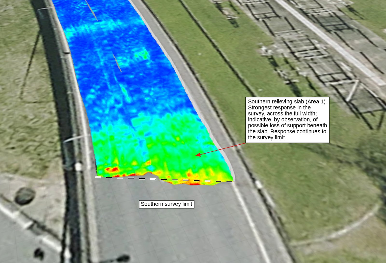
200 MHz depth slice at one end of the flyover. Red marks strong reflections, and the zone continues to the edge of the survey.
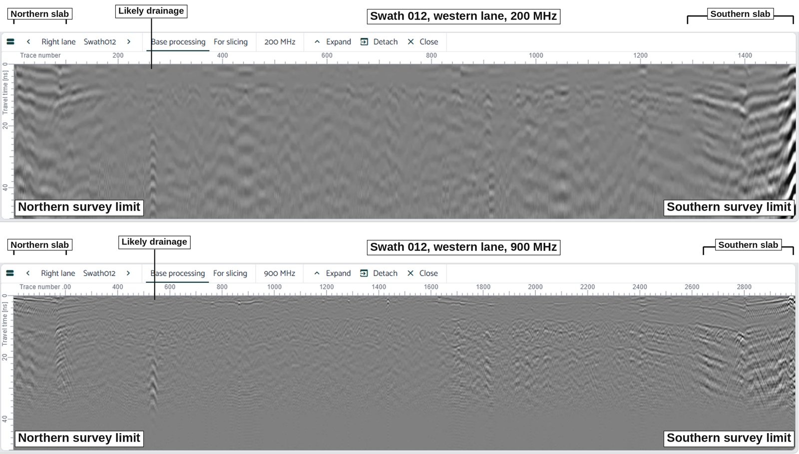
The same swath at 200 MHz (top) and 900 MHz (bottom). The 200 MHz signal carries far more information below the reinforcement.
Not every bright spot is a void
Part of the job is saying which responses are not voids. To keep the language consistent from the first page of the report to the last, every finding was placed in one of three categories.
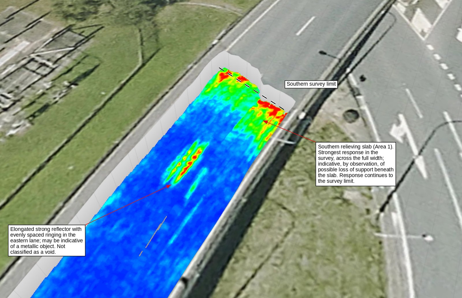
A strong, elongated reflector in one lane. Its ringing signature points to a metallic object, so it was reported as that, not as a void.
Indicative, by observation, of void or loss of support.
Anomalous response, cause undetermined.
Consistent with drainage infrastructure or services.
Alongside the two slabs, the survey picked up a localised response consistent with drainage at the edge of the carriageway, a transverse band of unknown cause near mid-length, and a near-surface response over the more affected slab that showed only at 900 MHz.
Findings to act on within days, without breaking out the pavement
The client's engineers received a georeferenced dataset and a report they could act on within days of the first phone call. The report identified where intrusive checks should go, flagged that the responses ran to the edge of the nominated area, and recommended extending the scan at both ends so the full extent can be mapped before any remediation is designed.
- Responses consistent with loss of support beneath both relieving slabs
- Which slab carries the stronger response, and where it is strongest
- Three other responses classified, none of them reported as a void
- A georeferenced baseline for a repeat survey after remediation
- Full extent, as the responses at both slabs run past the survey limits
- Thickness and volume of any void, which 200 MHz data cannot resolve
- Depths, which are held back until the signal velocity is calibrated against a core
- Cause and structural significance, which sit with the structural and geotechnical engineers
The report was issued for discussion with the client's engineering team. It recommends verification by intrusive means at locations nominated by the engineer, preceded by service clearance, before any finding is relied upon for design or remediation.
Running both frequencies at once meant one night on site instead of two. Being disciplined about what the data shows, and what it does not, gave the engineers findings they could rely on and a clear list of what still needed testing.
Concerned about what is under your slab?
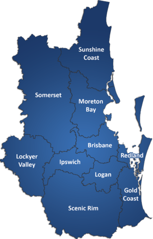
We undertake GPR investigations of relieving slabs, hardstands, bridge approaches and pavements, including night works under traffic control. We're a Queensland-based NDT consultancy specialising in ground penetrating radar, utility locating, concrete scanning and structural diagnostics.