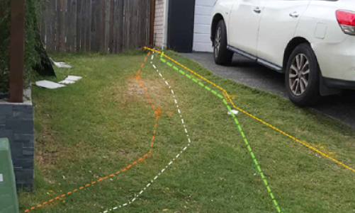
Locating underground utilities in coastal areas like the Sunshine Coast presents unique challenges. The region's sandy soils and high underground moisture content can make detecting buried utilities more complex. For utility locators working in suburbs such as Maroochydore, Noosa Heads, and Caloundra, accurate results can be harder to achieve, as sandy terrain can cause signals to scatter, complicating readings from ground-penetrating radar (GPR) and electromagnetic locators
Sandy Soils Impact Signal Clarity
In areas like Peregian Beach and Mooloolaba, the abundance of sandy soils significantly impacts utility detection efforts. Unlike compacted clay or loamy soils, sandy soil allows for signal scattering, mainly when using GPR. This scattering can obscure the location of metallic pipes, conduits, or even fibre optics buried at standard depths. Utility locators must adjust scanning frequencies and use multiple methods, like combining electromagnetic detection with GPR, to mitigate these difficulties.
Underground Moisture and Utility Detection
Another factor that adds complexity is the elevated moisture content commonly found in Sunshine Coast suburbs like Coolum Beach and Kawana Waters. Coastal regions often have higher groundwater levels, especially near rivers or areas prone to rainfall. Moisture can amplify signal interference and increase the difficulty of detecting non-metallic utilities, such as PVC pipes or ceramic conduits, particularly in places like Buderim and Nambour. Utility locators in these regions must apply advanced techniques, including using lower-frequency GPR units that penetrate moisture-heavy soils more effectively.
Coastal Construction Boom and Utility Mapping
The Sunshine Coast is experiencing significant growth, particularly in suburbs such as Birtinya and Sippy Downs, where construction of new housing developments and commercial properties is booming. This urban expansion creates an increased demand for utility locating services. However, the frequent excavation in these coastal areas means underground utility records may only sometimes be accurate. Utility locators are called upon to survey complex networks, where shifting sands and poorly documented pipes or cables create additional challenges. Staying vigilant and using advanced detection tools becomes critical to ensuring the safety of construction crews and preventing service disruptions.
Why Accurate Utility Locating Matters
Accurate utility mapping is essential in a fast-growing region like the Sunshine Coast, where new developments regularly pop up in areas such as Mountain Creek and Warana. It is important to locate utilities to avoid costly mistakes, such as rupturing water mains, damaging communication lines, or cutting power supplies. In coastal areas, where erosion and shifting sands may move buried utilities over time, it’s more critical than ever for utility locators to invest in precise, reliable detection technologies.

Optimising Utility Locating in Coastal Conditions
- Combining GPR with electromagnetic locators.
- Ensuring regular calibration of equipment.
- Working closely with local councils and developers.
In conclusion, the utility locating challenges posed by the Sunshine Coast’s coastal conditions require careful planning, the right technology, and expert knowledge of the region. Suburbs such as Twin Waters and Wurtulla offer unique difficulties, but with the right approach, utility locators can safely and accurately map the underground networks essential to the area’s growth.