Project Overview
South-East Scanning conducted a detailed ground penetrating radar (GPR) survey for Logan City Council at Tomohon Heights Close, Logan Village, QLD. The primary focus was to inspect an elevated road section for under-slab voids that could undermine the structural integrity of the roadway.
Methodology
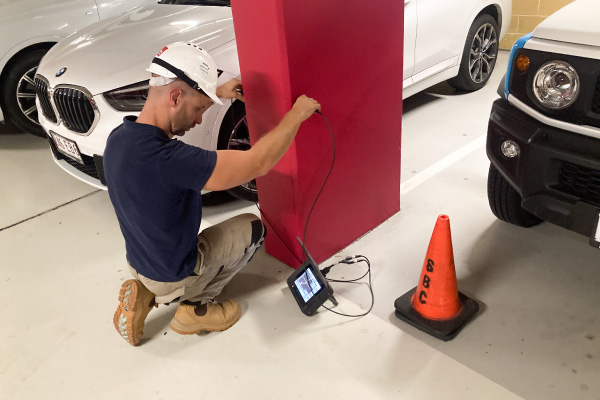
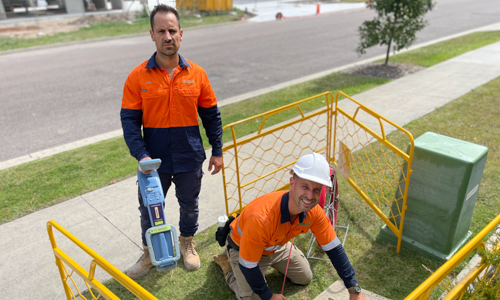
The survey employed the Proceq GP8000 and Impulse Radar PinPointR systems, known for their high-resolution concrete scanning capabilities and precision in subsurface imaging. These systems, operating at optimal frequencies for concrete penetration, facilitated the identification of material property changes beneath the concrete slabs. A comprehensive grid scan of the designated area ensured thorough coverage and minimised the risk of overlooking critical data.
Key Learnings
Detection of Sub-Slab Voids: The survey identified minor voids along the edge of the road, with depths ranging from 20-30mm. These voids, while not currently posing a structural threat, highlighted potential areas of concern.
Importance of Multi-Frequency Scanning: Utilising multiple frequencies allowed for a more detailed analysis of the subsurface, enhancing the detection capabilities for both shallow and deeper features.
Critical Role of Data Analysis: Real-time data analysis enabled immediate identification of anomalies, ensuring swift documentation and decision-making during the survey process.
Challenges
The survey faced a couple of challenges:
Complex Subsurface Conditions: The varied density and moisture content of the subsurface materials occasionally hindered signal clarity, necessitating careful calibration and interpretation of the GPR data.
Interpretation of Findings: Distinguishing between minor voids and other subsurface anomalies required expert analysis to ensure accurate assessments were made.

Outcomes for the Client
The GPR survey provided Logan City Council with crucial data on the condition beneath the elevated road section. The identification of voids, although minor, allowed the council to consider preventive measures to maintain the road’s integrity and prevent future issues.
This case study exemplifies the effectiveness of GPR technology in infrastructure maintenance, particularly in assessing potential risks like under-slab voids. South-East Scanning’s expertise in utilising advanced GPR techniques not only delivered significant insights into the subsurface conditions but also highlighted areas for future monitoring and intervention.
The proactive approach in employing GPR surveys helps in maintaining the safety and durability of public infrastructure, ensuring that minor issues can be addressed before developing into major structural concerns. For more information on how we can help you with your project, contact us!