You've lodged your BYDA (Dial Before You Dig) enquiry, and a pack of utility plans has landed in your inbox. It feels like the hard part is done. In reality, it's the start of the process, not the end of it — a BYDA request confirms which utility owners have assets near your site, but it doesn't verify where those assets actually sit in the ground. Here's what your plans do and don't tell you, and what happens next.
A BYDA (formerly Dial Before You Dig) enquiry is a free, nationwide referral service. Submit your site details and BYDA forwards your request to registered asset owners in the area — water authorities, gas networks, telcos, electricity distributors — who return plans showing the approximate location of their infrastructure. It's the essential first step for any excavation project and, in most states, a legal requirement before you break ground.
What it isn't is a locate. BYDA plans are desktop records, compiled from asset owner databases that can be decades old, incomplete, or simply wrong where infrastructure has been repaired, rerouted, or installed without as-built documentation being updated.
Every BYDA plan pack sits somewhere on the AS5488 Quality Level scale — the Australian Standard used to classify how much confidence you can place in underground utility information. Records-only data, without any physical or geophysical confirmation, is QL-D: the lowest confidence level on the scale.
Records Only
Based purely on existing BYDA/asset owner plans — often outdated or incomplete.
Surface Inspection
A site visit confirms visible features like maintenance holes and pits — no GPR or EMF readings taken.
Geophysical Detection
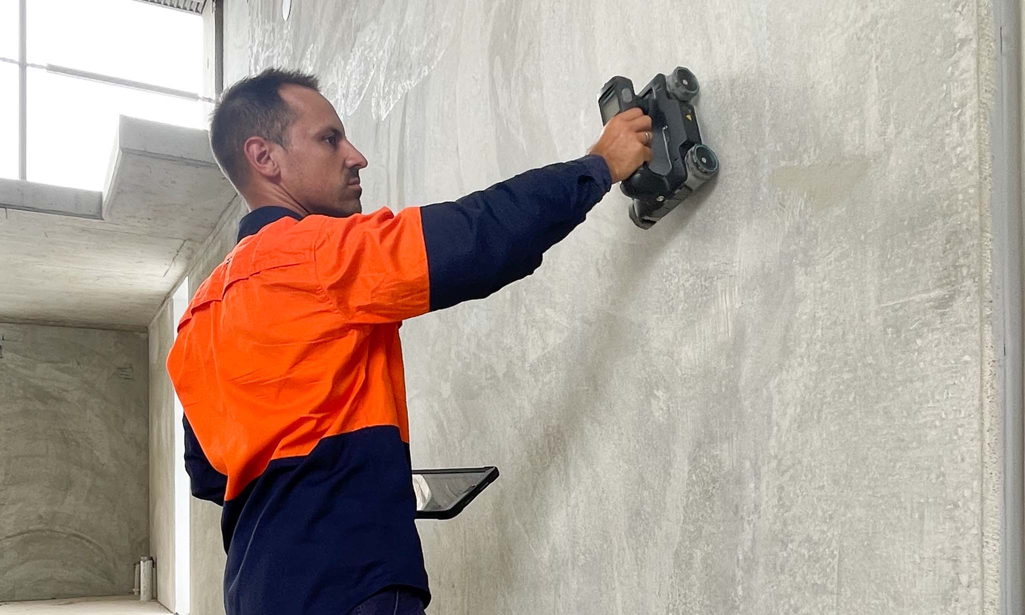
GPR and EMF locate utilities below the surface, confirming position and depth on site.
Physically Verified
Utilities are exposed via potholing or hydro excavation — the highest confidence level available.
A BYDA pack on its own will never move you past QL-D. That's not a flaw in the service — it's simply outside its scope. Moving to QL-B or QL-A requires a certified locator on site.
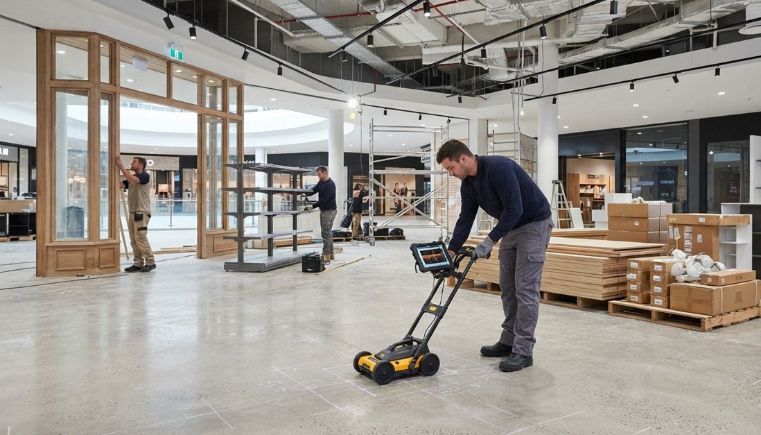 Moving From QL-D Records to QL-B Verification
Your BYDA pack lists which asset owners have infrastructure near your site, with indicative plans marking the approximate corridor of each service. Under AS5488, on-site markings from BYDA/QL-D data carry a 300mm width and 500mm depth tolerance — meaning the "line" on your plan represents a zone, not a precise point. Every pack also includes a disclaimer from asset owners limiting liability for accuracy, which is worth reading properly rather than skimming past.
Treat your BYDA plans as a starting map, not a working drawing. They tell you who to be cautious of and roughly where — the exact position and depth still need to be confirmed on site before any excavation, drilling, or cutting begins.
Not every project needs a full locate — but several common scenarios push you well beyond what a BYDA pack can safely support:
| Factor | BYDA / DBYD Plans | Physical Utility Locating |
|---|---|---|
| Data source | Asset owner records | On-site GPR, EMF & potholing |
| Typical quality level | QL-D | QL-B to QL-A |
| Confirms exact depth | No | Yes |
| Covers private services | Rarely (public assets to boundary) | Yes, where scoped |
| Best used for | Initial risk screening | Confirming safe dig zones |
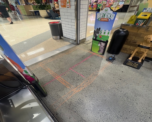 On-Site Verification
 Confirmed Safe to Proceed
Once your BYDA pack is in hand, closing the gap to a verified site is a straightforward process: get a quote and confirm scope, book a site visit, have a certified locator scan and physically verify the marked corridors, and receive an AS5488-referenced report you can hand to your engineer or site team. You can see the full step-by-step process on our Dial Before You Dig services page.
A plain-English breakdown of AS5488 Quality Levels — what QL-D through QL-A actually mean for your project.
Download the Guide →-
Is Dial Before You Dig (BYDA) free in Australia?
Yes — lodging a BYDA enquiry and receiving asset owner plans is free nationwide. The service of having a certified locator attend your site, physically verify those plans, and issue a site report is a separate, paid service.
-
What happens after you lodge a BYDA enquiry?
Registered asset owners near your site send back plans showing the approximate location of their infrastructure. From there, it's on you (or your locator) to physically confirm those services before excavating, since the plans alone are QL-D — records only, not a locate.
-
How do I read my BYDA plans?
Each plan shows the asset owner, the approximate utility corridor, and a liability disclaimer. Under AS5488, markings from records-only data carry a 300mm width and 500mm depth tolerance — treat the lines as an indicative zone, not an exact position.
-
Who do I contact if my BYDA plans don't match the site?
A certified utility locator, such as South East Scanning, can physically scan and verify actual site conditions against your BYDA records — flagging any discrepancies, undocumented services, or private infrastructure not shown on the plans.
-
Can I get a Dial Before You Dig guide as a PDF?
Yes — our free AS5488 Quality Level guide (linked above) explains QL-D through QL-A in plain English, so you know exactly what confidence level your current data sits at.
A BYDA enquiry is the right first move on every excavation project — but treating the plans it returns as a locate is where most preventable strikes happen. If your project involves excavation, cutting, or coring near marked corridors, the next step is physical verification, not assumption. South East Scanning is a CERTLOC Certified locating organisation, working to AS5488 standards across South East Queensland. Request a quote or read more on our Dial Before You Dig services page to see how the process works end to end.